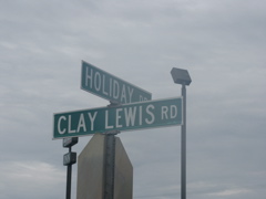
This sign in Clarksville, Tenn. was interesting to me. My grandfather's name was Clay Lewis. I have no idea who Clay Lewis of Clarksville is but it was still kinda neat to see my grandfather's name on a street sign.
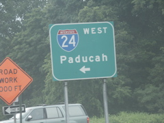
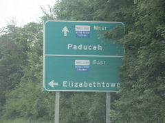
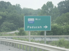
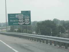
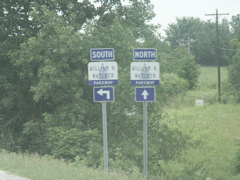
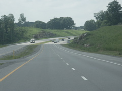
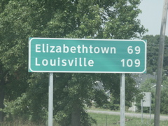
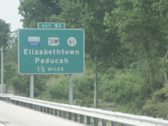
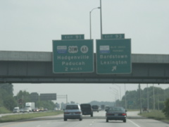
The control city for I-24 at Clarksville is Paducah.
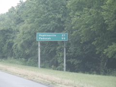
Paducah is shown on mileage signs along I-24 west in the Clarksville area.
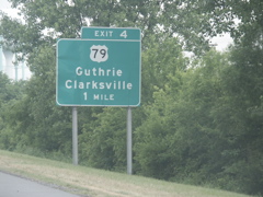
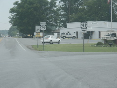
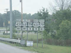
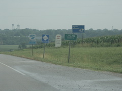
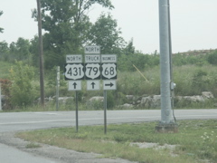
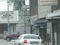
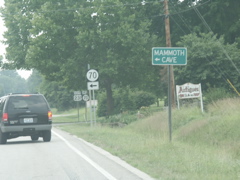
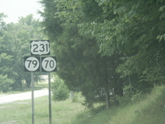
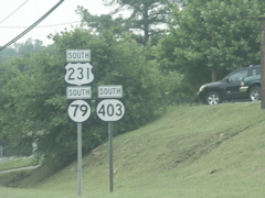
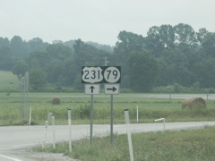
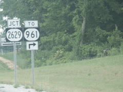
Destinations for the US 79 exit in Tennessee are Clarksville and Guthrie. I found it odd that such a small town in Kentucky would be the destination instead of the larger Russellville.
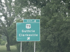
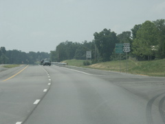
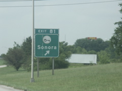
Exit here for US 79.
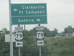
Lots of destinations to reach on US 79.
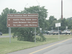
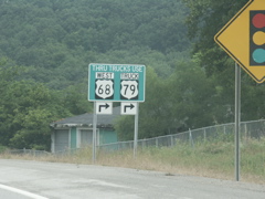
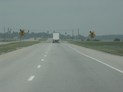
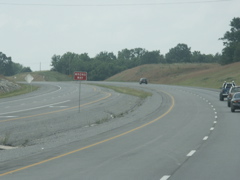
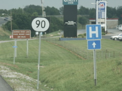
Signage at the end of the ramp from westbound I-24.
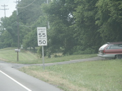
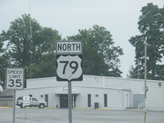
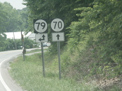
Tennessee has a split speed limit on two-lane US 79 north of I-24.
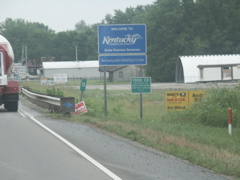
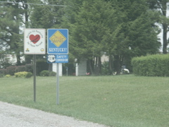
Entering Kentucky on US 79.
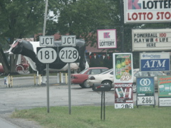
Approaching KY 181 and KY 2128 on US 79 north.
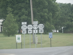
Signage for KY 181, KY 294, KY 2128 and US 79.
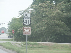
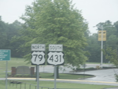
Approaching US 41 on north US 79.
US 41 crosses US 79.
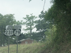
Closeup of US 79 reassurance marker.
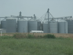
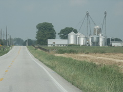
Big feed mill on US 79.
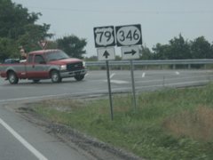
KY 346 and US 79 intersection.
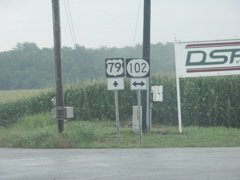
KY 102 crosses US 79.
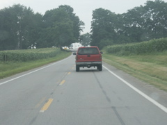
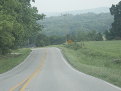
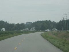
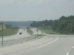
Typical view of US 79 heading toward Russellville.
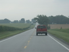
Another shot of US 79 in a very rural and agricultural-based part of Kentucky.
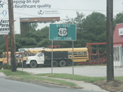
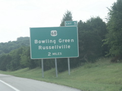
At Russellville, a truck route for US 79 is routed onto the bypass although US 79 ends in just a few miles.
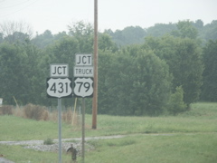
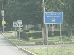
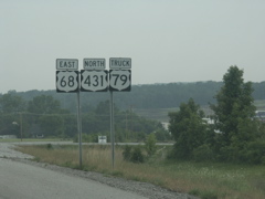
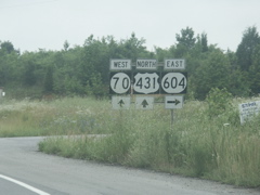
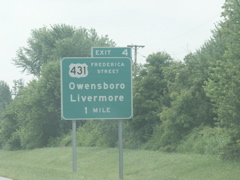
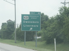
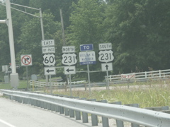
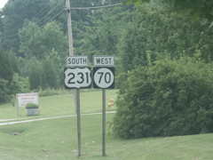
US 431 joins US 79.
Wrong-way multiplex of US 79 north and US 431 south.
US 431 prepares to split from US 79.
Split of US 431 and US 79.
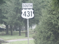
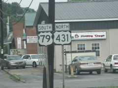
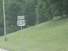
South US 431 sign heading out of Russellville.
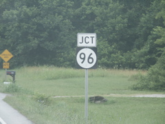
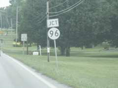
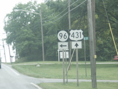
Approaching KY 96 on the south outskirts of Russellville.
This KY 96 sign uses a very odd font.
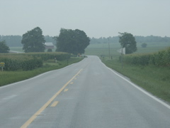
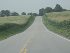
This is a typical scene along US 431 between Russellville and the Tennessee state line.
Another view as US 431 bisects a corn field.
This portion of US 431 has been improved. Around the curve is the Tennessee state line.
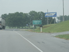
Entering Tennessee on US 431.
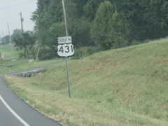
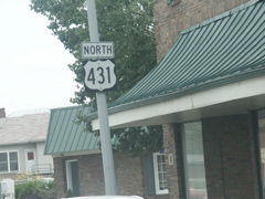
The first US 431 marker in Tennessee.
Looking back into Kentucky on northbound US 431. Ugh -- they missed getting rid of one of those God-awful "Education Pays" signs.
US 431 in Kentucky.
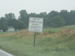
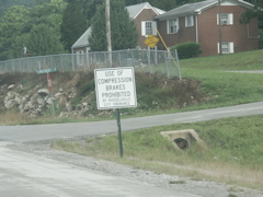
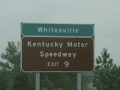
Lots of towns along my trip had "No Jake Brakes" or "Jake Brakes Prohibited" signs but none were as detailed as this one.
Back to KY 96.
KY 96 signage again.
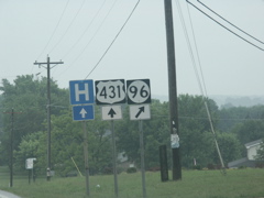
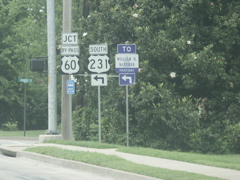
Approaching US 79 on northbound US 431.
Northbound US 431 turns left onto southbound US 79.
Going north and south at the same time.
US 431 turns onto the Russellville Bypass.
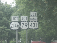
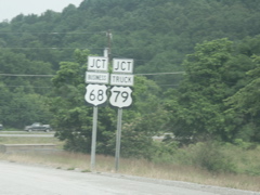
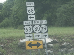
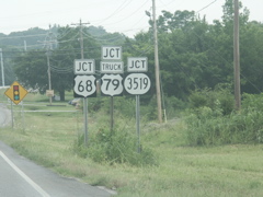
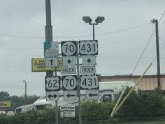
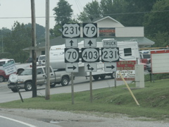
Three US routes.
US 431 is a four-lane route but with an at-grade railroad crossing.
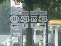
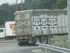
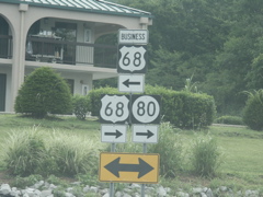
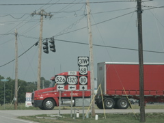
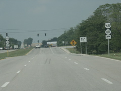
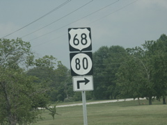
Approaching US 68. All references to KY 80 have been removed from US 68 and the Russellville bypass.
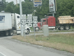
US 431, Truck US 79 and Business US 68 signage.
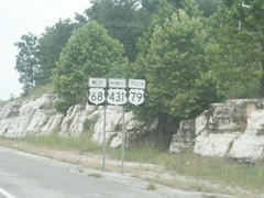
Overhead signage for US 68 at the bypass. No mention of KY 80.
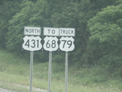
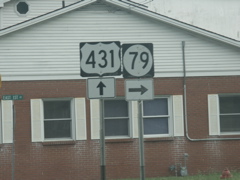
US 68, US 431 and Truck US 79.
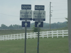
This is looking south on the four-lane US 431 north of Russellville. US 431 has been routed onto the US 68 bypass and a business route makes a left turn, then a block later turns right onto the old two-lane US 431.
Another shot of the "compression brakes prohibited" signage that can be found at every approach to Russellville. This one is on US 68/KY 80 heading west into town.
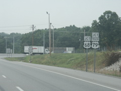
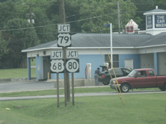
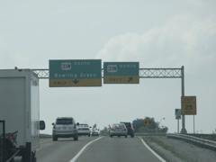
This sign alerts trucks to use the US 68 bypass, including trucks going west on US 68 that are heading for South US 79. US 79 and US 68 make up the most direct route between Clarksville and Bowling Green.
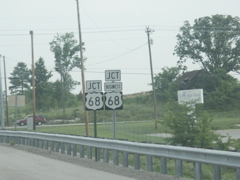
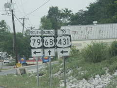
Junction signage for Business US 68 and Truck US 79 on US 68 westbound.
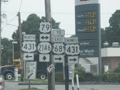
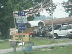
At one point there were about 10 or so route markers on this assembly. The number has been pared down to three.
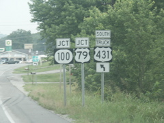
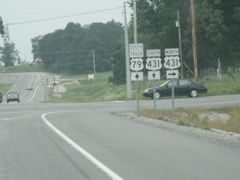
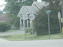
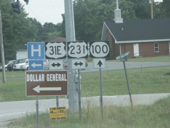
Heading into Russellville on Business 68, these are the signs for the approaching junction of KY 100 and US 79. Interesting that trucks heading south for US 431 are directed to use US 79, while trucks headed for US 79 are directed to take the bypass!
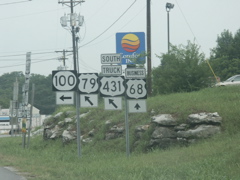
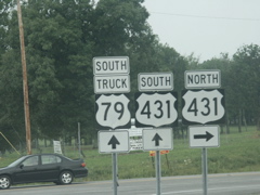
The intersection of Business US 68, US 79 and KY 100 is oddly configured. KY 100 takes a hard turn left while US 79 takes a diagonal turn.
This is the signage seen at the end of US 79.
This signage greets travelers as they approach Russellville on KY 100.
This is the signage that drivers see when they reach the end of KY 100.
Just past the photo seen previously with signage for both KY 100 and US 79, this one has US 79 only.
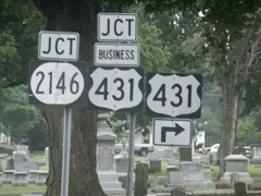
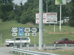
Square US 431 sign on the downtown business route, just north of the city's central square and where Business 431 crosses Business 68.
This marks the southern terminus of KY 79, which does not intersect US 79 but can logically be viewed as a continuation of the southwest-to-northeast diagonal path the US route takes into Russellville. KY 79 goes to Morgantown, Caneyville and then on up into Breckinridge County and provides an Ohio River crossing into Indiana.
Looking north on Business US 431. KY 3519 is the number given to the old two-lane route of US 431 that runs north of the bypass.
For a brief stretch, Business 431 is signed with US 68 and Truck US 79.
This is where US 431 meets US 68.
Closeup of the signage in the previous photo.
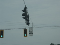
As is done elsewhere, the US 68 signs are suspended from the traffic signal wires. These signals have been surrounded by yellow reflective tape to enhance their visibility.
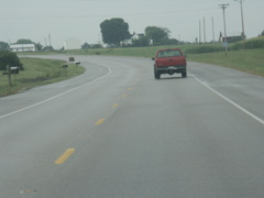
Northbound on US 431 out of Russellville.
As the four-lane ends, the quality of US 431 quickly goes downhill, so to speak.
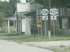
US 431 and KY 106 intersect. The K Y 106 sign uses the same odd font as the KY 96 sign shown earler.
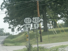
And after KY 106, there is KY 107.
KY 106 departs US 431. This sign also sports the same unusual font, most easily noticed in the shape of the "6."
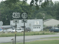
At Drakesboro, US 431 picks up KY 70.
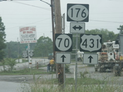
KY 176 crosses US 431 and KY 70. KY 176 here is signed with the oval shaped shield rather than the elliptical one with the flat top and bottom that are more commonly seen on Kentucky roads.
This stretch of US 431 and KY 70 is a Kentucky Scenic Byway.
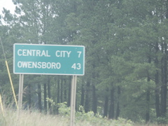
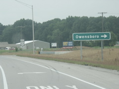
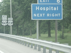
Owensboro begins showing up on the mileage signs.
There have been some improvements made to US 431 in this area, including at the intersection of KY 604.
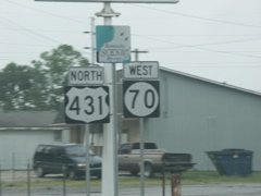
Just south of Central City, US 431 and KY 70 have an interchange with the Western Kentucky Parkway. Since this was the location of a toll booth, the exit is a cloverleaf so even though you are going north on US 431, you have to turn left to go east.
And similarly, you have to turn right and go around a loop to head west toward Paducah.
At Central City, US 431 and KY 70 cross US 62. Because of a low clearance railroad crossing in downtown Central City, US 431 truck traffic is directed to bypass the city via US 62 west.
KY 70 departs US 431 in downtown Central City.
KY 189 is a route that connects Central City and Greenville, and forms the truck bypass for US 431.
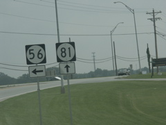
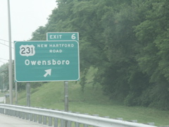
North of Central City, KY 81 turns left and provides an alternate route to Owensboro through Bremen, Sacramento and Calhoun.
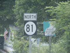
KY 81 is a Kentucky Scenic Byway.
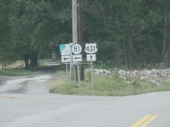
KY 175 joins KY 81.
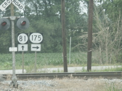
Just beyond a railroad crossing, KY 175 departs KY 81.
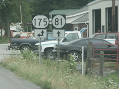
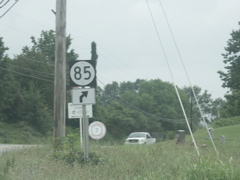
At Sacramento, KY 85 joins KY 81.
Despite its odd number, KY 85 is signed as an east-west route because that is its major direction of travel.
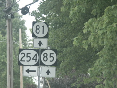
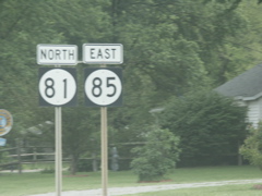
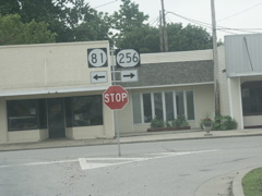
KY 81, KY 85 and KY 254 in Sacramento.
KY 81 and KY 85 markers with no directional banners.
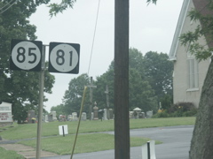
KY 85 prepares to leave KY 81.
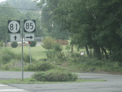
The junction of KY 81 and KY 85 north of Sacramento is a "Y."
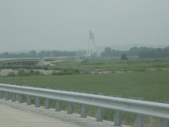
Looking north on KY 81 in the community of Rumsey. Looming in the distance is the new bridge crossing the Green River into Calhoun.
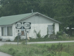
KY 138, signed in an oval, crosses KY 81 in Rumsey.
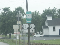
KY 138 leads to the Pennyrile Parkway, as do so many roads in this region.
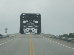
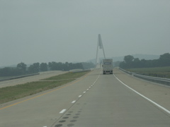
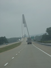
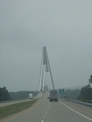
Crossing the new Green River bridge, which was built in the early 2000s. My first time in this area was in 1995, and the bridge here was very old and narrow.
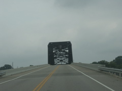
Another shot of the Green River crossing on KY 81.
And yet another shot.
On the old bridge, KY 81 made a 180-degree loop after it crossed the bridge and intersected KY 256, then it made a 90-degree left turn. Now the road makes a 90-degree right turn after the bridge and intersects KY 256 at a point after the previously-mentioned 90-degree left turn.
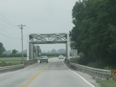
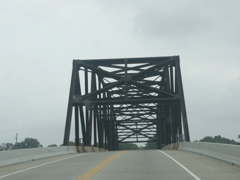
An older-style truss bridge on KY 81 nearing Owensboro.
At one point, KY 81 and KY 54 were multiplexed from this spot into downtown Owensboro. Then KY 54 was truncated in Owensboro and this route became KY 56. Now KY 56 ends and KY 81 continues solo into downtown.
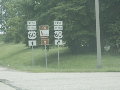
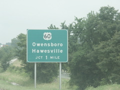
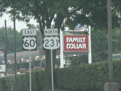
KY 81 intersects the US 60 bypass.
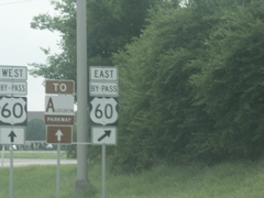
The Audubon Parkway runs parallel to KY 56 in this area and is well-signed at the KY 81 intersection with the US 60 bypass.
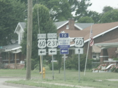
This is a newer exit along the US 60 bypass.
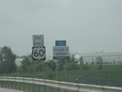
The Natcher Parkway is well-signed along the US 60 bypass.
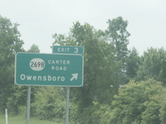
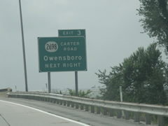
The KY 2698 exit.
Back to US 431. Frederica Street is the major north-south thoroughfare in Owensboro and hosts the city's booming suburban commercial district.
US 431 exit.
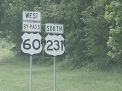
This US 60 sign looks like it belongs in West Virginia, not western Kentucky.
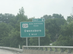
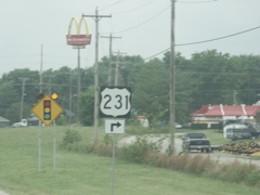
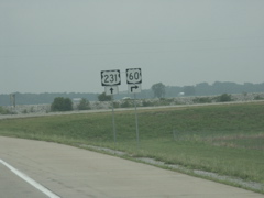
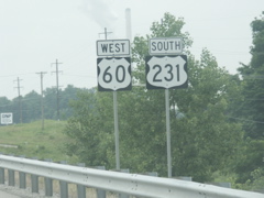
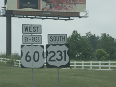
US 231 intersects the bypass in one mile.
Due to the rerouting of US 231 across the Natcher Bridge, northbound US 231 is routed along the US 60 bypass. Surface signage indicates that north US 231 traffic should continue straight on the bypass.
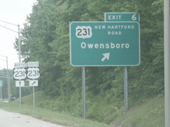
Exit signage for US 231 with accompanying surface signage.
Mounted on the US 231 overpass is an exit sign for the Natcher Parkway. This sign is a bit different than normal Natcher signs in that it uses a traditional shade of blue, not the purple-blue commonly seen, and there is no outline of the Capitol dome.
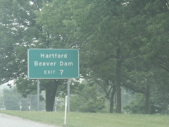
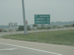
Use the Natcher to reach Hartford and Beaver Dam, towns in Ohio County which is directly south of Daviess County.
In front of the guide sign for the Natcher Parkway are the US 60 and US 231 signs.

The exit for the Natcher Parkway, formerly known as the Green River Parkway.
KY 54 runs to Leitchfield, where it ends on the courthouse square.
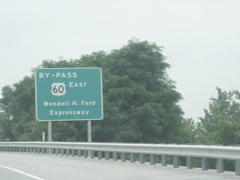
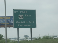
Unfortunately the state of Kentucky has seen fit to waste money by putting up big green signs announcing the bypass as the Wendell Ford Expressway. Former senator and governor Ford is NOT one of my favorite Kentucky politicians.
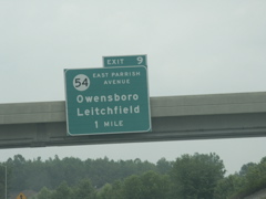
More destinations for the KY 54 exit.
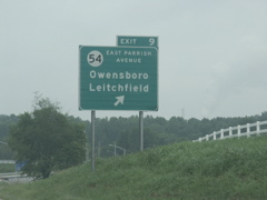
Exit here for KY 54.
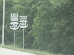
More US 60 and US 231 markers. The US 60 sign uses an unusual font.
The end of the Owensboro bypass approaches.
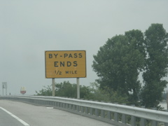
This sign cautions drivers that they will have to stop in a half mile.
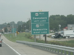
Directional signage for US 60, with a surface sign for US 231 in the background.
This is the sign directing US 231 traffic to turn right.
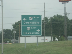
Directional signage for US 60 at the end of the bypass.
This is the end of the Owensboro bypass.
US 60 and US 231 east of the bypass.
Approaching the intersection where US 60 east departs US 231.
Advance turn signage for US 60.
US 60 turns, US 231 continues straight.
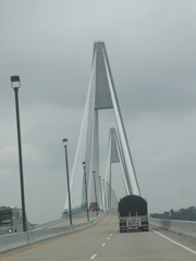
Looking in the distance at the Natcher Bridge crossing the Ohio River into Indiana, andone of several bridges along the fill for the elevated US 231 route.
Another shot approaching the bridge.
Looking ahead to the cable-stayed bridge.
Another shot approaching the bridge.
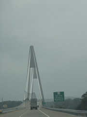
Getting closer...
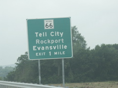
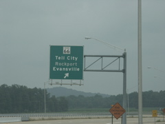
Exit sign for IN 66. The word "Rockport" is in a slightly different shade (not as bright of a white) as Tell City and Evansville.
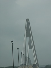
On the bridge.
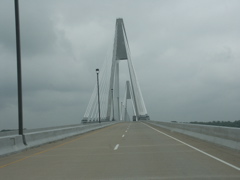
Another shot on the bridge.
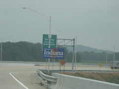
Entering Indiana on US 231.
Overhead IN 66 sign. Again the word "Rockport" is in a slightly different color.
Signage at the end of the ramp from US 231 to IN 66.
Turning back onto the bridge and heading for Kentucky.
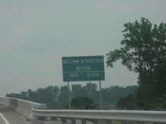
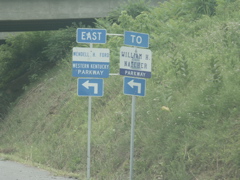
Signage for the William H. Natcher Bridge and the Ohio River.
Heading south on US 231.
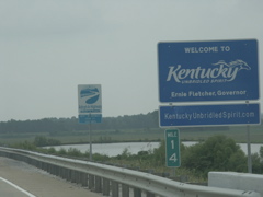
Entering Kentucky on US 231.

The US 231 connector between the bridge and US 60 crosses several bridges over dry land, including this one seen in the distance.
Back to the US 60 intersection.
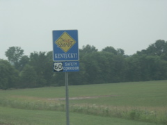
US 60 is a designated safety corridor by the Drive Smart program, and as such is the site of many enforcement blitzes and an intense PR campaign.
US 60 and US 231 signage.
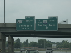
This sign directs traffic wanting to use the US 60 bypass of Owensboro to bear left.
Junction signage for the US 60 bypass.
Out of focus shot at the turn onto the bypass.
US 60 and US 231 signage on the bypass.
Another big sign feting Wendell Ford (yuck).
The US 60 bypass takes you to the Natcher Parkway.
More US 60 and US 231 signs.
One mile to the Natcher.
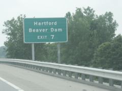
Hartford and Beaver Dam again.
Overhead signs for the Natcher and US 231 exits.
More US 60 and US 231 signage on the bypass.
US 231 leaves the Owensboro bypass.
At the end of the off-ramp, US 231 turns left and joins its traditional routing.
These signs are posted at the south end of the bridge that carries US 231 across the bypass.
Across the road from the previous photo are these signs directing traffic turning onto the on-ramp.
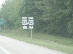
This US 231 sign looks like it belongs in Tennessee.
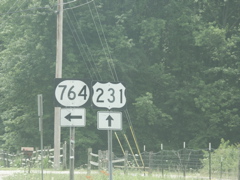
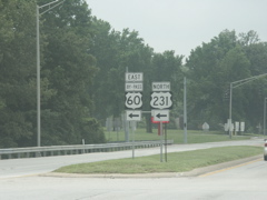
US 231 and KY 764 intersection south of Owensboro.
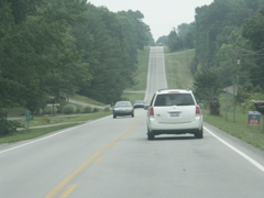
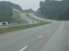
South of Owensboro, US 231 passes through more rolling terrain than do the other routes traveled on this trip. There are fewer farming operations as well.
KY 136 finally comes to an end at US 231 north of Hartford.
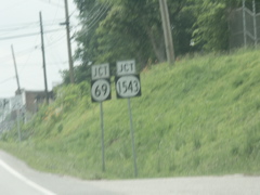
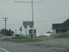
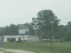
KY 69 intersects US 231 near Hartford.
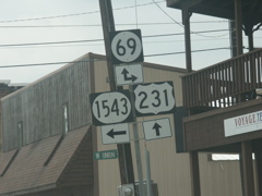
Intersection of KY 69, US 231 and KY 1543.
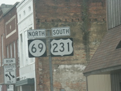
Wrong-way multiplex of US 231 and KY 69.
KY 69 departs US 231.
Although the Hartford exit for the Natcher is KY 69, there is no trailblazer marker for the Natcher here.
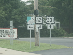
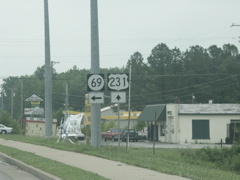
US 231 joins US 62 in Beaver Dam.
US 62 and US 231.
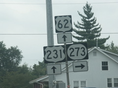
US 62, US 231 and KY 273.
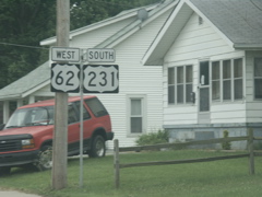
Split of US 62 and US 231.
US 231 intersects the Western Kentucky Parkway.
This sign shows the difference in colors between the standard blue used in Kentucky parkway signs and the purple-blue used in Natcher Parkway signs.
Not too far from the WK interchange, US 231 intersects the Natcher. This was the site of a former toll booth so the interchange is a cloverleaf.
KY 70 joins US 231 north of Morgantown, near Aberdeen.
US 231 and KY 70.
Just a bit south, KY 79 joins the route. No US 231 signage here though.
Here are markers for US 231, KY 79 and KY 70 without directional banners.
US 231 crosses a high bridge over the Green River as it enters Morgantown.
KY 70 has a new interchange with the Natcher outside of town. It, along with KY 403, offers a truck route to keep big trucks from navigating the 90-degree right turns in downtown Morgantown.
KY 70 departs US 231 and KY 79.
US 231, KY 79 and KY 403 signage.
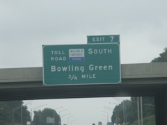
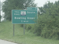
This sign south of Morgantown was the only one I saw anywhere that had the "Toll Road" supplemental banner.
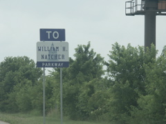
More Natcher Parkway signage.
US 231 and KY 79 south of the Natcher.
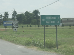
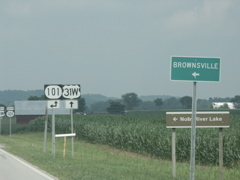
KY 79 splits from US 231, headed to Russellville.
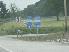
On the Natcher Parkway, US 68 is signed but KY 80 is not.
More supplemental destinations for the US 68 exit.
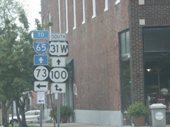
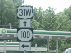
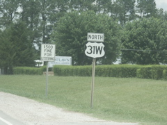
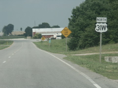
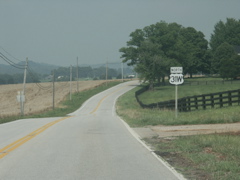
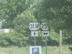
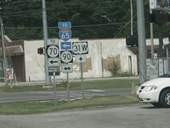
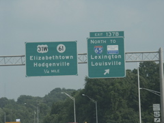
US 31W exit signage on the Natcher.
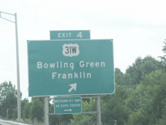
The US 31W exit.
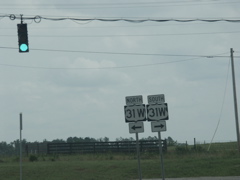
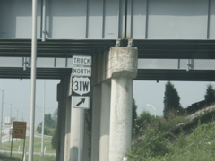
US 31W shields at the end of the off-ramp, with two distinctive shield shapes.
US 31W is another Drive Smart safety corridor in this region of Kentucky.
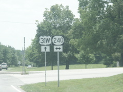
KY 240 crosses US 31W.
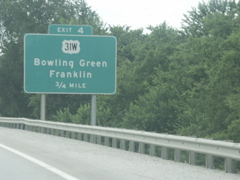
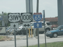
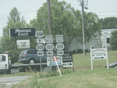
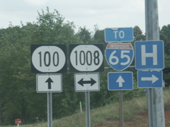
Approaching the KY 1008 bypass around Franklin.
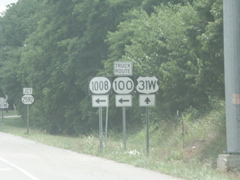
KY 1008 nearly forms a circle around Franklin. It beings at US 31W north of town and goes three-fourths of the way around town, coming back out on KY 100 on the west side.
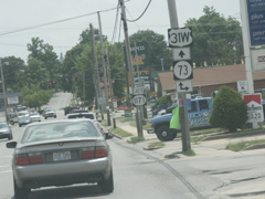
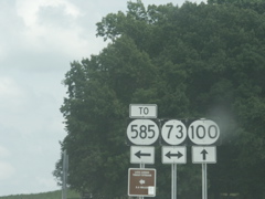
In downtown Franklin, US 31W picks up KY 73.
At one time, KY 100 and KY 73 were together when the came into town. Now a new routing of KY 100 from the interstate exists so the two routes are separate.
Signage where the new KY 100 turns left.
KY 1008 crosses US 31W on the south side of Franklin.
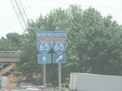
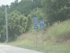
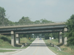
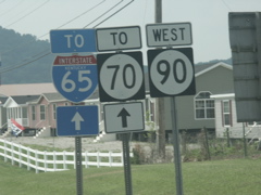
US 31W represents the first exit for I-65 inside Kentucky. Currently there is a widening project taking place on the interstate as evidenced by the construction equipment in the background.
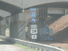
Part of the widening project is an expansion of the bridge carrying the interstate over US 31W.
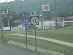
Posted in Kentucky are these Tennessee junction signs on US 31W.
Looking at the state line.
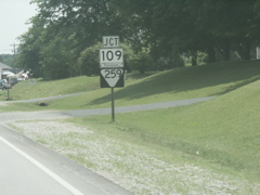
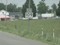
This is the turnoff for TN 109, just inside the state line in Tennessee.
Closer view of the mileage sign, first US 31W marker in Tennessee, and the Tennessee welcome sign.
Looking back north on US 31W, here is the TN 109 junction sign.
Looking north at the state line.
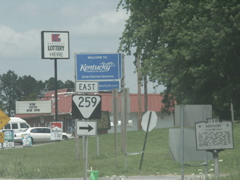
A closer view shows the TN 259 intersection with the Kentucky welcome sign in the background.
First US 31W sign in Kentucky.
US 31W safety corridor and Buckle Up Kentucky signage.
Back at KY 1008 south of Franklin.
This is on eastbound KY 100 at the KY 1008 crossing.
KY 73 crosses KY 100.
In Scottsville, KY 100 crosses the relocated US 31E/US 231 bypass of town.
This shot shows a bannerless KY 100 marker beyond the US 31E/231 intersection.
Even though we are already on US 231 north, a junction sign is posted.
This is the point where US 231 splits from US 31E. KY 980, to the right, is the old routing of US 231 into town.
US 231 has been four-laned from Scottsville to Bowling Green. This shot looks north on the new road just outside of Scottsville.
Looking toward the Allen/Warren county line on northbound US 231.
Crossing into Warren County on new US 231.
KY 2629 carries part of the old US 231 routing.
Approaching Bowling Green on US 231.
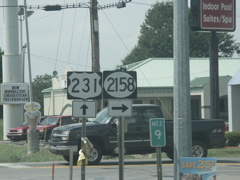
Just south of I-65's busy Scottsville Road interchange with US 231, KY 2158 is signed in an oval.
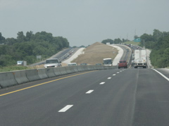
Construction is ongoing on I-65 in the Bowling Green area.
An example of Clearview font on this mileage sign along I-65 at Bowling Green.
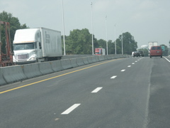
This shot shows the widening work on I-65 with the unique local/express traffic patterns. Oncoming traffic here was diverted out of the traditional southbound lanes and is unable to exit at US 231. Traffic wanting to exit at Bowling Green was diverted to the southbound lanes. Only one lane is available for local and express traffic.
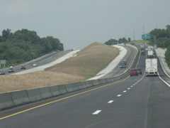
Another view of the setup.
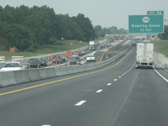
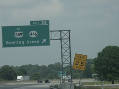
This shows where the two lanes of southbound I-65 are split, we are looking north near new Exit 26.
Exit sign for KY 446, which is posted only on the new I-65 signage and not on the route itself or US 31W.
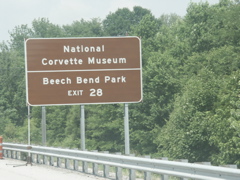
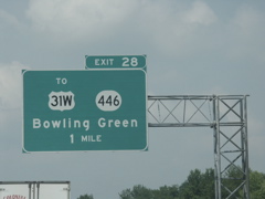
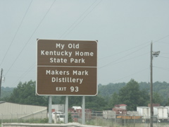
These attractions are available at Exit 28.
The KY 446 exit.
Crossing under I-65 on the KY 446 connector to US 31W.
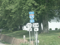
Not signed on these overheads are US 68 and KY 80, which also run along US 31W.
Split at the end of KY 446.
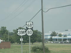
Mile marker along US 31W showing the mileage belongs to it, not US 68 or KY 80.
Plenty of signs at this intersection north of Bowling Green.
US 31W, US 68 and KY 80 signs with no directional banners.
Split of US 68/KY 80 from US 31W north of Bowling Green.
Closeup of US 68/KY 80 signage.
North of US 68/KY 80, US 31W narrows from four lanes to two.
Looking at the spot where US 31W narrows to two lanes.
A feed mill operation along two-lane US 31W.
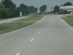
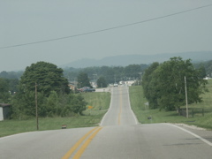
Typical scene along US 31W.
Portions of US 31W include a passing lane.
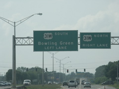
KY 101 and US 31W join.
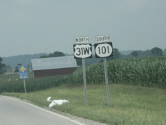
Wrong-way multiplex of US 31W north and KY 101 south.
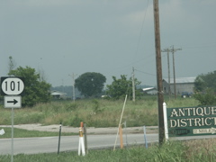
KY 101 splits from US 31W.
Another rolling section of US 31W with a passing lane, this time for southbound traffic.
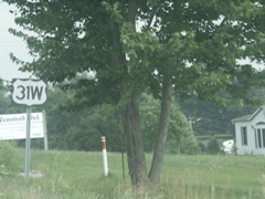
Bannerless US 31W sign.
KY 259 crosses US 31W.
South of Cave City, US 31W crosses under I-65. The metal bridge beams are rusting and in need of sanding and painting.
KY 255 and US 31W intersect.
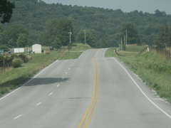
Typical rolling section of US 31W approaching Cave City.
Intersection of US 31W and KY 90. When I reached this spot, I clinched US 31W in Kentucky.
KY 90, KY 70 and I-65 state name signage.
Approaching the end of KY 90.
This is the end of KY 90.
KY 90 in wide marker usually reserved for three- or four-digit routes.
Back into the Eastern time zone -- on I-65.
Peeling KY 84 marker on this I-65 exit sign.
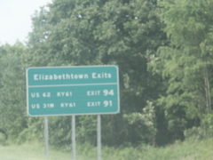
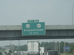
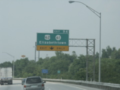
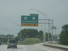
Exits for Elizabethtown on I-65.
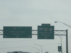
Approaching the WK Parkway, US 31W and KY 61 on I-65 northbound.
More exit signage for the WK.
These signs are posted on the C/D ramps at the interchange of I-65 and the WK Parkway.
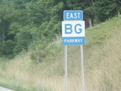
Overhead at I-65 and the BG Parkway with the new Martha Layne Collins Bluegrass Parkway signage.
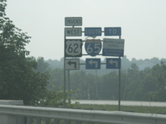
Overhead for the US 62/KY 61 exit.
The ramp merging from the BG Parkway provides an exit-only lane for the US 62/KY 61 exit.
The northernmost E-town exit.
On US 62, truck traffic is directed to use I-65.
Overheads looking south on I-65 at the BG Parkway.
This will be a Road Sign Math sign! 31 + 61 - 1 = 91.
Exit 91, the WK Parkway, takes you to some of western Kentucky's most major towns.
Approaching Exit 91.
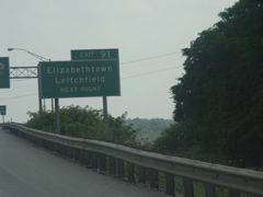
Leitchfield is the first city west of I-65 on the WK Parkway.
Overheads at the WK Parkway Exit.
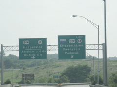
Overheads at the split on the C/D ramp.
Overhead signage on the C/D ramp paralleling southbound I-65.
Overhead signage on the WK Parkway at the I-65 exit.
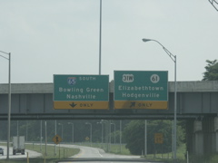
Truck US 31W sign on the C/D lane paralleling northbound I-65.
Clearview font on I-65 north.
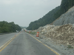
A rockfall mitigation project on the BG Parkway east of E-town has traffic reduced to one lane in each direction, separated only with pylons.
Exit 10 on the BG Parkway, former site of the road's first toll booth.
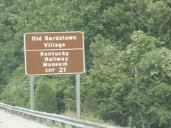
Tourist destinations reached via Exit 21 on the BG Parkway.
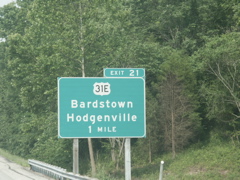
US 31E one-mile sign on the eastbound BG.
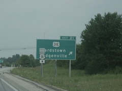
Trucks should use the BG Parkway, US 150 and KY 245 instead of following US 31E through downtown Bardstown.
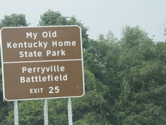
Clearview font on a tourist destination sign on the BG Parkway Exit 25.
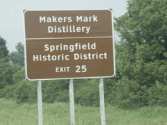
More Clearview.
This exit was the site of a toll booth on the BG Parkway. The exit is still a cloverleaf.
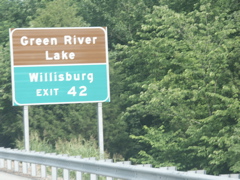
Use Exit 42 for Willisburg and Green River Lake.
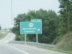
Exit 42. KY 555, in conjunction with KY 55 and US 68, forms an improved corridor from the BG Parkway all the way south to Greenville.
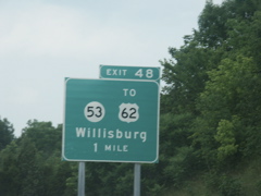
KY 53 and US 62 on the one-mile sign for Exit 48.
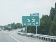
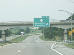
BG Parkway Exit 48. Lots of cedar trees dot the landscape in this section of Kentucky.
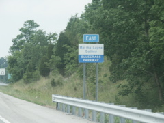
The new Martha Layne Collins Bluegrass Parkway signage.
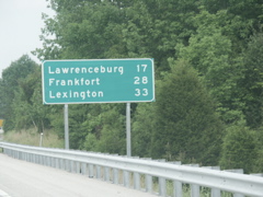
Frankfort starts showing up on mileage signs.
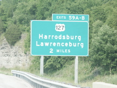
Exit 59 allows BG Parkway traffic to use two separate ramps for north and south US 127 traffic.
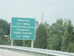
Danville and Frankfort are also accessible via Exit 59.
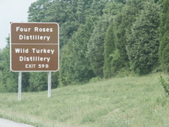
Tourist destinations for US 127 north.
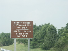
And for US 127 south.
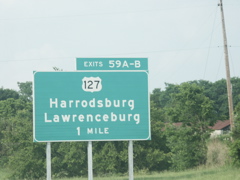
One-mile sign for US 127 exit.
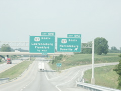
Overheads at US 127. This exit used to be a cloverleaf because a toll booth was located here. The ramps have been rebuilt into a diamond interchange but they still use the cloverleafs exiting the parkway in each direction for separate access to north- and southbound US 127.
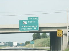
Overhead on the bridge for the US 127 north exit.
Oops, they missed one -- perhaps the last remaining old-style BG Parkway sign. East of the US 127 exit.
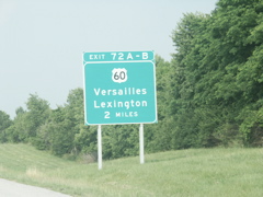
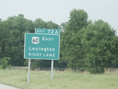
Getting closer to Lexington.
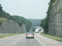
Vertical rock cuts as the BG Parkway descends to cross the Kentucky River.
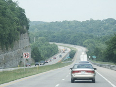
Approaching the Kentucky River bridge.
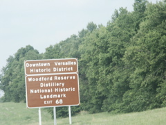
Tourist destinations in Versailles.
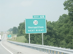
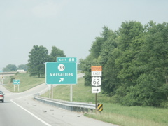
The KY 33 exit was originally only a partial exit. Ramps to the eastbound BG and from the westbound BG were added after the tolls were removed.
At the time this photo was taken, the US 62 bridge crossing the Kentucky River was closed for repairs, so US 62 was detoured onto the Bluegrass Parkway.
Approaching the end of the BG.
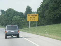
One-mile Parkway Ends sign.
Getting closer to the end.
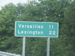
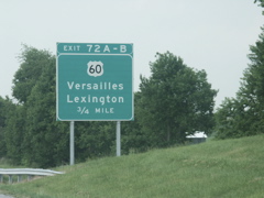
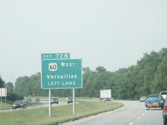
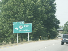
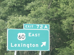
Signs on both sides of the road designate lanes for Versailles and Lexington.
Closeup view of the left sign.
Closeup view of the right sign.
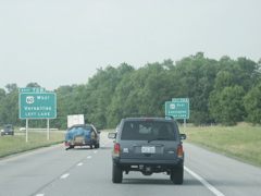
Looking at the end of the BG Parkway.
Another closer shot of the terminus.
And yet another closer view.
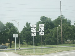
The sign for the left turn.
And for the right turn.
The end of the BG Parkway.
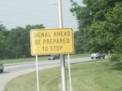
A warning for a traffic signal on US 60 east of the parkway's terminus.
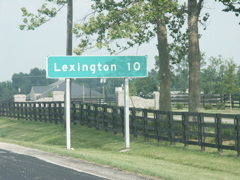
Only 10 miles to Lexington.