|
The Trip To DC
|
| Signage for Exits 50 and 53 on I-64 eastbound near Charleston, WV. Both exits are for the same route, WV 25. |
| Signage for Exits 53 and 54 on I-64 eastbound near Charleston. WV. |
| Signage for Exits 58A and 58B on I-64 eastbound approaching Charleston, WV. These new signs replaced older button copy signs installed on the brown metal supports that used to have a wire mesh grid. |
| Signage for approaching intersection of Interstates 64, 77 and 79. |
| Signage for Exit 59, I-77 North, to I-77 on I-64 eastbound in Charleston. This sign was installed on the old brown metal support. |
| Another sign for Exit 59. |
| Signage at the exit showing lane departure and a 50 mph advisory. |
| Diagrammatic sign for Exit 104 on northbound I-77 for the I-79 split. |
| Signage at Exit 104 and the I-77/I-79 split, installed on the brown metal support. |
| Exit 67 on I-79 northbound. This is where US 19 splits from I-79 following a multiplex from the end of Corridor L. |
| Overhead signage at Exit 67. |
| Signage for Exit 91 on I-79 northbound, US 19 at Roanoke. The US 19 shield is missing from the southbound exit signs to keep motorists from thinking that Corridor L departs the interstate at this location. Scroll down to near the bottom of the page to see an example. |
| Signage at Exit 91. Yes, that's snow you see falling in the photo. |
| My last name on a Big Green Sign. This sign is in advance of Exit 99 on I-79 northbound. |
| Destination signage at the end of the off-ram at Exit 99. |
| Overhead signage for Exits 117 and 119 on I-79 north. The sign for Exit 117 is button copy. |
| Overhead signage for Exits 119 and 121. Notice the overturned tractor-trailer on the loop ramp from US 50 east to I-79 north. |
| Overhead signage for Exits 124 and 125. The snowfall is starting to pick up a bit. |
| Overhead signage for Exits 132 and 133. Notice the signage for the famous West Virginia "fractional" county route. |
| Button copy sign for upcoming Fairmont exits. |
| Signage for Exit 137 at Fairmont. |
| Signage for "I-79 High Tech Corridor." West Virginia has named several of its routes as various corridors. |
| Directional signage for upcoming Exit 148, the western beginning of I-68. |
| Overhead directional signage for I-68 exit. |
| The first exit on eastbound I-68, Exit 1 for US 119. |
| I-68 shield with state name near Morgantown. |
| Overhead signage for Exit 4 on eastbound I-68. |
| Another I-68 shield with the state name in West Virginia. |
| Signage for Exit 23 on eastbound I-68. This is the last state route exit in West Virginia. |
| Signage for Exit 29. This is the last exit in West Virginia. |
| Welcome to Garrett County sign on eastbound I-68, entering Maryland from West Virginia. |
| First I-68 shield in Maryland. |
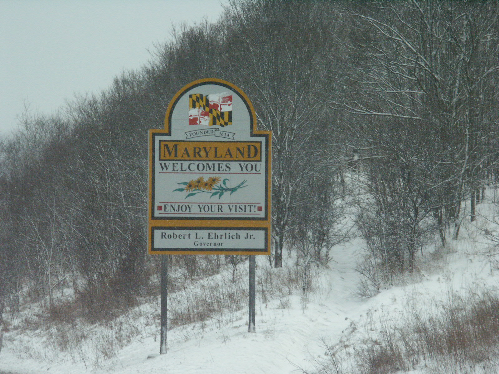
| Maryland welcome sign on eastbound I-68. |
| Wildlife alert sign on eastbound I-68 in Maryland. |
| Maryland seat belt sign on eastbound I-68. |
| Warning sign for truckers to use an alternate exit for Westernport and Luke. |
| Signage for Exit 4 on eastbound I-68. This is the first exit in Maryland. |
| Small sign at Exit 4. It's obvious that this is a temporary replacement for a larger sign that has been knocked down. |
| Warning sign to truckers to use flashers on an upcoming steep grade. |
| "Lane ends" sign denoting the end of a truck climbing lane. |
| Overhead signage for Exits 14 A-B. This is the spot where US 219 and US 40 join I-68. |
| Overhead signage at Exit 14. Notice that the sign is almost totally obscured by snow. At this point in the trip, in the higher elevations of Maryland, it was snowing at a pretty decent clip. |
| Signage for Exit 19. Since Maryland also has an Interstate 495, this is evidence that Maryland has no problems with duplicating numbers between categories of routes. |
| Signage for Exit 22. This is the point where US 219 leaves the freeway. |
| Chesapeake Bay Watershed sign on eastbound I-68. |
| Nearly obscured by snow, it's the Eastern Continental Divide sign on eastbound I-68. |
| Blank variable message sign on I-68 approaching Cumberland. |
| Signage for Exit 40, Truck US 220 South. |
| Overhead signage at Exit 40. |
| Truck lane restriction warning sign approaching Cumberland. |
| Overhead signage showing upcoming Cumberland exits and truck lane restrictions. |
| Signage for Exit 42 with truck restriction. |
| Overhead signage at Exit 42. |
| Signage for Exit 44, US 40 Alternate. |
| Blue traffic advisory sign in Cumberland. |
| Signage for Exit 46, US 220 north. This will eventually be the southern terminus of the hated I-99. |
| Overhead signage at Exit 46. |
| Mileage sign for Hancock, Hagerstown and Baltimore on I-68 eastbound, east of Cumberland. This is the first sign on which Baltimore shows up as a destination. |
| Overhead signage for MD 144, National Pike, at Exit 52. |
| Mileage sign which includes I-70 shield, eastbound I-68. |
| Shot of the mountainous terrain in the western panhandle of Maryland, looking east on I-68. |
| Interesting mile marker on eastbound I-68. |
| National Freeway scenic byway sign. |
| Overhead signage for Scenic US 40, Exit 62. |
| Another interesting mile marker. |
| Shot of the Sideling Hill cut in the distance. |
| Another shot approaching Sideling Hill. |
| Signage at Exit 72, Scenic US 40. |
| Signage for Exit 74, Scenic US 40. |
| Signage for Sideling Hill Exhibit Center. |
| Signage for Exit 77, Scenic US 40 and MD 144. |
| Signage for ending of I-68 at I-70. |
| Signage warning of thru truck ban on MD 144. |
| Signage for Exits 82 A, B and C, the end of I-68 at I-70 and US 522. Notice the wide shield for I-70. |
| Button copy sign for I-70 west and US 522 north, showing everyone's favorite interstate bottleneck at Breezewood. |
| Overhead signage at the eastern end of I-68. |
| I-70 and US 40 shields just east of the I-68 interchange. |
| Button copy sign for a left exit on I-70, where US 40 departs the interstate. The exit number tab is not button copy and appears to be much newer than the button copy main portion of the BGS. |
| Better photo of another button copy sign for Exit 9. |
| Button copy sign for Exit 12, MD 56. If you look closely, you can see that the "1 Mile" wording is not button copy, and you can see shadows where the "Exit 1 Mile" text (formerly used on advance exit signs) was removed. You can also see what appears to be streaks where something has faded and dripped down the body of the BGS from the white button copy letters. |
| Button copy sign at Exit 12. You can see a shadow where the arrow has been moved from the center of the sign to the right. |
| Button copy sign for Exit 18, MD 68. Again you can see the shadow where the arrow was moved, and you can see how much newer the exit number tab is. Again, an example of how Maryland duplicates numbers for interstate and state routes. |
| Advance signage for Exit 26, I-81. Notice the "North & South" language, which is a bit unusual. |
| Additional destination signage for I-81 exits. |
| Overhead signage for the exit to the C/D lanes for I-81. |
| Slightly out-of-focus overhead signage for Exit 28 at Hagerstown and upcoming exits. |
| Button copy sign for US 40 exit at Hagerstown. Shadows can be seen where "Exit 1 Mile" was changed to merely "1 Mile." |
| Button copy mileage sign on eastbound I-70 for Frederick, Washington and Baltimore. FInally, Washington DC is beginning to show up on mileage signs. |
| Button copy sign for Exit 35, MD 66. Notice that the exit number tab is button copy and centered. |
| Blue travelers advisory sign for I-70 approaching Frederick. |
| Signage for Exit 48, US 40 at Frederick, with black-background US 40 shield. |
| Overhead signage for Exit 52A and B, US 15 and US 340. The "Charles Town" referred to is in West Virginia. |
| Surface sign for US 15-US 340 exit. |
| Overhead signage for Exit 52B and Exit 53. This is the first mention of the upcoming I-270 exit. |
| Overhead diagrammatical sign for split of I-70 and I-270. |
| Overhead lane designation sign for I-270 exit with the interchange in the background. |
| Exit gore signage for I-270 exit off of I-70 eastbound. |
| Overhead signage for upcoming Gaithersburg exits on I-270 eastbound. |
| Overhead signage for I-370 exit on I-270 eastbound. |
| Out-of-focus picture of overheads at split of I-270 and Spur I-270. |
| Out-of-focus picture of overheads at Exit 43 and Exit 44 on I-495 south (Outer Loop) in Virginia. |
| To I-495 shield on southbound George Washington Parkway. |
| Exit signage for I-495 and Turkey Run Park on southbound GW Parkway. |
|
The Trip Home
|
| Exit signage for I-81 at western end of I-66 in Virginia. |
| Overhead signage approaching the end of I-66. |
| Overhead signage at the end of I-66. |
| Exit signage for US 48 and VA 55 on southbound I-81. |
| Signage at the end of the exit ramp from I-81 to US 48 and VA 55. This marks the eastern terminus of US 48, the route number that will be given to Corridor H once it is completed in Virginia and West Virginia. |
| The first US 48 signage as seen from westbound VA 55 at the I-81 exit. |
| The first US 48 reassurance marker, just west of the I-81 exit. |
| The last US 48 marker in Virginia. The US 48 designation disappears at the West Virginia state line. |
| Looking east at the Virginia-West Virginia line, this is the first US 48 marker. |
| A closer view of the above scene. |
| A close-up of the first US 48 sign with the first VA 55 sign. |
| The first WV 55 sign. Notice that US 48 has disappeared. |
| Wider view of the first WV 55 sign with the "Welcome to West Virginia" sign in the background. |
| Advance turn sign for WV 55 approaching the WV 259 intersection in Wardensville. Notice the small "Engine Brakes Prohibited" sign. WV 55 sees quite a bit of truck traffic as it is the easiest crossing of the mountains separating Virginia and West Virginia for miles to the north and south. |
| Shot of construction on the four-lane Corridor H south of Wardensville. |
| Bridge piers for a bridge that will carry Corridor H across existing WV 55 and WV 259 south of Wardensville. |
| Following a WVDOT snowplow on WV 55 and WV 259. The snowplow appeared to be spreading cinders, not salt. |
| Another set of bridge piers for the under-construction Corridor H, where the route will cross existing WV 55 and WV 259. |
| Construction sign for Corridor H with an erroneous "US 55" shield. |
| Signage at the southern terminus of WV 29 near Hardy, seen from westbound WV 55 and southbound WV 259. |
| End WV 29 signage approaching WV 55 and WV 259. |
| Signage at the terminus of WV 29. |
| JCT WV 55 sign, with space to add a US 48 shield later, on WV 55 and WV 259 approaching the four-lane corridor H near Baker. |
| View of Corridor H overpass across WV 259 at what is now the eastern terminus of the four-lane portion of WV 55. |
| WV 55 entrance sign and detail of bridge abutment. |
| Looking east onto uncompleted portion of Corridor H from WV 259. |
| Small WV 55 west sign on northbound WV 259. |
| East WV 55 and North WV 259 signs at the point where WV 55 leaves the four-lane Corridor H alignment and rejoins its traditional route. |
| Looking east from Corridor H across WV 259 to under construction portion. |
| Vertical view of above photo. |
| Closer view of above photo. |
| West WV 55 sign on four-lane Corridor H. |
| Exit signage from eastbound WV 55 at end of existing Corridor H. This indicates that WV 259 north will continue along the four-lane. |
| Mileage sign on Corridor H. I could not tell if the distance listed to Elkins is via existing WV 55 or what the distance will be when Corridor H is completed. |
| Snow-covered Corridor H. |
| Another shot of snow-covered Corridor H. |
| Exit sign for WV 55 at current western end of this portion of Corridor H. |
| Half-mile advance sign for WV 55 exit in the midst of a snowstorm. |
| Signage at the WV 55 exit. |
| View of the exit where Corridor H currently ends. |
| WV 55 signage after you exit the freeway and cross the uncompleted portion of Corridor H. |
| Signage pointing to a shortcut to US 220 on WV 55 east of Moorefield. |
| Junction signage for US 220 and WV 28 approaching downtown Moorefield. |
| WV 55 advance left turn indicator approaching WV 28 and US 220, with the older non-reflective green destination sign nearly obscured by heavily falling snow. |
| US 220 and WV 28 signage at the intersection with WV 55. |
| Signage showing the "triplex" of US 220, WV 28 and WV 55. |
| Signage approaching the split of US 220 with WV 28 and WV 55 in downtown Petersburg. |
| Signage at the split of US 220 with WV 28 and WV 55. |
| Signage showing the "duplex" of WV 28 and WV 55 past the US 220 intersection. |
| Intersection of WV 28 and WV 55 at the southern terminus of WV 42, east of downtown Petersburg. |
| Intersection of WV 42 and WV 93 near Scherr, in the valley below Bismarck. At this spot the road begins a winding climb up a mountain range known as the Fore Knobs. |
| A snowy roadway going into a curve and climbing the Fore Knobs. It appears that West Virginia uses only cinders, not salt, on the highways in this region. |
| Signage at the split of WV 42 and WV 93 at Bismarck. Corridor H will use the alignment of WV 93 from here to the Davis region and the intersection with US 219. |
| Crossing the dam at Mt. Storm Lake on WV 93. It's nearly impossible to see the road due to the snow. |
| Approaching a curve past Mt. Storm Lake on WV 93. Where is the road? |
| Signage for WV 32 at the end of WV 93, between Davis and Thomas. |
| Signage at the intersection of WV 32 and WV 93. |
| End WV 32 signage approaching the intersection with US 219 at Thomas. |
| Snowy shot of US 219 signage at the end of WV 32. |
| Snow-covered US 219 between Thomas and Parsons. |
| Another shot of a snow-covered US 219. |
| Treacherous driving conditions in West Virginia's higher elevations. |
| Sign informing truck drivers of an upcoming mandatory brake check stop on US 219 southbound. |
| Hill warning sign approaching Parsons on southbound. |
| Intersection of US 219 and WV 72 near Parsons. |
| "Wrong-way multiplex" of US 219 and WV 72. |
| Signage for upcoming split of US 219 and WV 72 in Parsons. Notice the older WV 72 sign and the Texas-style "goalpost" sign post. |
| Signage at the intersection of US 219 and WV 72. |
| Shot of Corridor H bridge at Kerens, north of Elkins, from the connector route carrying US 219 from its old alignment to the new four-lane. |
| Signage at the end of the connector loop directing US 219 traffic onto Corridor H. |
| Looking north at the existing end of Corridor H at Kerens. |
| Looking south at the beginning of Corridor H at Kerens. |
| Another shot looking north. |
| Yet another shot looking north. |
| Mileage sign on Corridor H at Kerens. |
| 2-mile exit sign approaching Elkins. |
| South US 219 sign with empty post for later installation of US 48 sign. |
| 1-mile exit sign approaching Elkins. |
| Overhead signage approaching Elkins exit. |
| Overhead signage at Elkins exit. This is the spot where US 219 departs Corridor H and US 33 joins for the remainder of the length to I-79. |
| US 33 (with interesting font) and US 250 signs on Corridor H, taking over for US 219. |
| JCT WV 92 sign. WV 92 is the old route of US 33 and US 250. |
| Snow-covered signage at the intersection of US 33 and US 250 with WV 92. The US 33 sign is missing. |
| Looking back at signage for US 33, US 219 and US 250. This set of signs has changed several times since the Elkins Bypass portion of Corridor H opened a few years ago. |
| Overhead signage looking east on US 33. WV 92 used to be the old routing of US 33 and US 250. This sign has changed several times since 2000. See Adam Prince's Corridor H photo page for its evolution. |
| Signage for WV 92, US 33 and US 250. |
| Intersection of US 33, US 250, WV 92 and County 151 west of Elkins. County 151 is the old route of US 33 between Elkins and Buckhannon. This is a rare example of standalone county route signage in West Virginia. The county routes are usually signed on green signs indicating the route name as well as a small shield for the number. |
| Intersection of US 33 with US 250 and WV 92 west of Elkins. |
| Signage on southbound US 250/WV 92 at the US 33 intersection. |
| Button copy sign for interchange of US 33, US 119 and WV 20 at Buckhannon. At this exit, US 119 joins US 33 and the two routes run concurrently all the way to Spencer in the north-central part of the state. |
| Signage for US 33 and US 119. |
| Destination and mileage sign on US 33/US 119. For the first time, Charleston shows up as a destination. |
| Signage for the approaching I-79 interchange and the end of Corridor H. |
| Signage for Exit 91 on I-79 with the US 19 shield removed. |
| I-79 and WV 5 signs. |
| East WV 5 marker. |
| End WV signage approaching US 19 and WV 4. |
| The eastern end of WV 5. |
| Signage at Flatwoods where US 19 leaves its old route and joins I-79. |
| Green sign pointing to southbound I-79 and US 19. This is where US 19 joins the interstate. |
| Angled overpass crossing I-79 as seen from the southbound lanes. |
| Signage for Exit 5, WV 114 on southbound I-79, approaching Charleston. |
| Diagrammatical sign on I-79, approaching the southern terminus at I-77. |
| Blurry shot of overheads at I-77/I-64 interchange in Charleston. |
| Crossing the Kanawha River on westbound I-64. |
| Overhead signage for Exits 56 and 55 on westbound I-64. |
| Signage for US 60 at the end of Montrose Drive in South Charleston. |
| Construction on I-64 looking west at what will be the future terminus of US 35. |