
This photo was accidentally snapped, but it's a good photo showing the Mountain Parkway eastbound in Wolfe County, Just over the rise in the background is Exit 42 and beyond that, Exit 43 where the highway goes from four lanes to two.

New overhead signage showing the new Mountain Parkway sign.

The next of three overheads on which the Mountain Parkway sign has been changed.

Finally, the third overhead at the spot where the Mountain Parkway goes from four lanes to two.

This bridge construction project is at the Mountain Parkway-KY 30 interchange in Magoffin County. The bridge is being replaced to reduce the superelevation in the curve and make the highway safer.

These signs are in Floyd County. To the right, KY 1428 is the old routing of KY 80 west. To the left, it's the old routing of US 23 north and US 460 west.

These signs for US 23, US 460 and KY 80 are just beyond the KY 1428 intersection.

Guide sign for the US 119 intersection just north of Pikeville.

Advance sign for US 119 intersection.

At the intersection of US 119 with US 23/460 and KY 80.

The first sign showing all four routes that run through the Pikeville area.

Exit number tabs have been added to the two exits along the Pikeville Cut-Thru on US 23. The mileage is figured from the Pike-Letcher county line on US 23.

Another of the exit number tabs that have been added.

This route marker assembly is not an assembly at all; rather, it's four separate sign posts.

This exit sign also has had an exit number tab added.

For several years there were a number of oversized route marker signs for the major highways in the Pikeville area. All of those signs have been removed except for this assembly near the southern end of the Pikeville Cut-Thru.

This assembly marks the end of what is believed to be the most numbered highways to share one stretch of pavement -- a "quintuplex" of highways are on a short stretch of pavement south of the Pikeville Cut-Thru.

This is a view of the four-lane south of Pikeville, showing a rockfall retaining wall protecting the northbound lanes of US 23/119 and the westbound lanes of US 460/KY 80.

Advance sign for the split of US 460 and KY 80 from US 23/119.

These two signs replaced oversized signs for advance warning of the split.

These signs also replaced oversized markers to show the split of US 460 and KY 80 from US 23 and 119. This is near Shelbiana, south of Pikeville.

US 460 and KY 80 markers south of the split from US 23/119.

This assembly uses only one directional banner for the two routes.

This photo shows a recently rebuilt section of US 460/KY 80. Flooding in the spring resulted in this section of roadway being washed out. The road was rebuilt and opened to traffic pretty quickly.

This bridge carries US 460/KY 80 over an old section of the roadway and the Levisa Fork of the Big Sandy River, downstream from Fishtrap Lake. It bypassed an older bridge, a T intersection and an at-grade rail crossing.

The split of KY 80 and US 460 at Belcher, north of Elkhorn City.

Standalone US 460 marker. This is the first such marker in Pike County, the road having been co-signed with other routes all the way from the Floyd County line to this point.

At the KY 1499 intersection at Mouthcard, US 460 turns to the south only about three miles from the Virginia state line.

Entering Virginia from Kentucky on US 460 eastbound. The actual state line is behind the camera, in a curve.

The first US 460 sign and mileage board in Virginia. Claypool Hill is where US 460 intersects US 19.
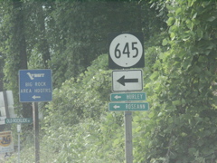
Virginia Secondary 645 sign with small destination markers.

A bridge deck replacement project was underway on US 460 between the state line and Grundy.

Advance signage for the VA 83 intersection in Grundy.

This shot shows the work that is ongoing to relocate a flood-prone section of Grundy. The work is being done by the U.S. Army Corps of Engineers in conjunction with the construction of new US 460, Corridor Q in the Appalachian Regional Commission highway system.

A shot of the work taking place to demolish old buildings in the flood plain.

Oops! The first of many signage errors encountered on this trip. VDOT placed an erroneous "US 83" sign in place of a VA 83 marker in Grundy.

Another shot of the erroneous sign. This appears to be a VDOT installation instead of a temporary contractor's sign.

VA 83 splits from US 460 at Vansant, just south of Grundy.

VA 83 and DMV signage at the split from eastbound US 460.

Bristol is listed as a destination as US 460 departs the Grundy area, but is reached by US 19 south from Claypool Hill.

The route sign is missing from this mileage sign, located on US 460 in the Keen Mountain area.

Getting closer to Richlands, US 460 descends a mountain.

US 460 and VA 67 combine briefly in Richlands.

A business route for US 460 takes VA 67 away from the bypass route, which passes Richlands to the north.

I have photographed this sign several times before, so I didn't feel too badly about cutting off the US 460 sign. This is the first mention of Roanoke as a destination for US 460.

On the Richlands bypass.

Still on the Richlands Bypass.

Approaching the US 19 intersection at Claypool Hill.

At the US 19 intersection.

The first signage for the combined US 19 and US 460.

An underpass along US 19/460 just southwest of where the business routes split for Tazewell.

The old alignment of US 19/460 goes through downtown Tazewell (a cutout enthusiast's delight) while the bypass skirts downtown to the north and west.

US 19 and US 460 signage on the Tazewell bypass.

Exit sign for Alt. VA 16.

A few miles further down the road is this exit sign for VA 16.

This exit sign for VA 61 is a little different than the ones for VA 16 and Alt. VA 16.

The first US 19/460 signage beyond the Tazewell bypass.

Advance exit signage for US 19's departure from the Appalachian corridor.

The US 19 exit sign is in the distance in this shot of an I-77 sign. I-77 in this area is accessed in West Virginia.

The US 19 exit and the start of the newer US 460 bypass of Bluefield.

An exit sign for VA Secondary 720, which parallels US 460 in this area.

The exit for VA 720.

Half-mile advance sign for the VA 102 exit.

A typical view of US 460's bypass of Bluefield, Va.

Not sure why this US 460 sign is perched atop this VA 102 exit sign. The exit is actually for VA Secondary 720; it intersects VA 102 just to the north of this interchange.

Perhaps that missing US 460 sign needed to be mounted on this mileage sign, just past the VA 102 exit.

Approaching the West Virginia state line on US 460. The actual state line is at the pavement change and the small blue mile marker that can be seen at right.

Closeup shot of the new West Virginia welcome sign.

Mileage sign for Bluefield exits on US 460.

WV 598 is the old route of US 52 and the decommissioned US 21 across East River Mountain, into Virginia.

Advance signage for the WV 598 intersection.

At the WV 598 junction with a Corridor Q mile marker visible.

Advance signage for the split of the brief US 460/WV 598 multiplex. WV 598 leads to north US 52 into downtown Bluefield.

Destinations for WV 598 north with signage at the intersection in the background.

WV 598 departs US 460.

Closeup shot of the West Virginia ARC Corridor Q mile marker. This is similar to other mile markers that have been installed on other ARC corridors in West Virginia.

Mileage sign on US 460 beyond the WV 598 intersection. As a rule, West Virginia uses the state for out-of-state destinations. This sign even includes a comma after "Pearisburg."

And, of course, WV has named its entire system of ARC highways after Robert Byrd.

Two-mile exit sign for US 52.

Going east on US 460, the turn for US 52 north is not signed as such because US 52 traffic has been directed to use WV 598 north some miles back. Instead, the route is signed only as County 29, Cumberland Road. Heading back west on US 460, this intersection is fully signed as the departure of northbound US 52.

This signage confirms that US 52 has joined US 460.

One-mile exit sign for US 52's departure from US 460.

Half-mile exit sign.

Overheads for the upcoming exit.

This is the sign that could be seen in the distance from the earlier photo. US 460 makes a sweeping left-hand turn and drops down the mountain to re-connect with US 19.

US 52 sign on the connector route from US 460 to I-77.

Construction on I-77 in Virginia is noted on US 52 in West Virginia.

Mileage sign for the I-77 interchange and to Wytheville.

Junction sign for I-77.

Advance signage for the intersection, where US 52 joins I-77 to go through the East River Mountain Tunnel and into Virginia.

At the turn for the ramp to south I-77.

Crossing the bridge, a left turn puts you on the ramp to northbound I-77.

Entering I-77 northbound, this sign greets you whether you've gotten on at Exit 1 or crossed into West Virginia from Virginia.

Typical view of I-77 northbound descending East River Mountain. Cable barriers have been installed here.

Another shot of I-77, getting ready to cross the East River.

No surprise that West Virginia starts promoting Tamarack not long after I-77 enters the state.

This road used to be posted as "Ingleside Road" rather than Twelvemile Road.

The exit for County 27 with a railroad overpass in the distance.

Shot of the railroad overpass across I-77.

US 460 intersects I-77 after the interstate reaches the top of the mountain above the East River valley.

One-mile exit sign for the US 460 interchange. Southbound, this exit is also signed for Pearisburg, Va.

The US 460 exit marks the southern terminus of the West Virginia Turnpike but there is no sign denoting this is the last exit before entering the turnpike. A welcome center is also located at this exit.

Looking east on US 460, beyond Princeton, heading toward Virginia.

Junction sign for WV 112 on east US 460.

Advance turn sign for WV 112.

Oakvale and Kellysville are the communities served by WV 112 between here and Bluefield.

Looking at the WV 112 intersection and beyond on eastbound US 460.

Entering Virginia from West Virginia on US 460 east. The pavement change marks the state line.

US 460 enters Giles County when it crosses back into Virginia, and the town of Glen Lyn.

This older style welcome sign greets travelers as they enter Virginia. Of course they see the whole sign and not just part of it, since the rightmost edge got cut off in this photo.

The first US 460 sign and mileage sign after the route re-enters Virginia.

US 460 approaching Blacksburg is designated Virginia's Technology Corridor.

This photo shows the four-lane path of US 460 with the US 219 southern terminus upcoming. To the right of the road is the New River.

Advance signage for US 219's southern terminus at Rich Creek.

Signage where US 219 turns from US 460. US 219 uses a short connector route to get to the old alignment of US 460, then uses that for a short distance to get to the spot where the road turns toward West Virginia.

This is looking west on Old Virginia Avenue, which is the old alignment of US 460 through Rich Creek. This is not actually US 460 although it is marked as such here.

This is on current US 460, appraching the US 219 intersection.

This is also on existing four-lane US 460, looking west. There are no signs at the actual intersection of US 219 as you travel west on US 460.

At the end of the short connector road between US 460 and Old Virginia Avenue, this sign guides drivers to US 219 north.

This is looking east on Old Virginia Avenue, which is old US 460. The sign in the previous photo can be seen at left (the truck is passing by it).

This is on Old Virginia Avenue, looking east, where US 219 makes a 90-degree left turn to head toward West Virginia.

Back on US 460 east, this is the mileage and route marker sign beyond the US 219 intersection.

This shows the "narrows" of the New River between Rich Creek and Narrows. In this location, the westbound lanes of US 460 are separated from the eastbound lanes. The EB lanes are adjacent to the river and the WB lanes sit higher on the hillside.

A look at the eastbound lanes of US 460 through the narrows.

This bridge carries VA 61 across US 460 at Narrows. The bridge also spans the New River. VA 61 loops around and ends at a traffic light just around the curve.

Signage at the terminus of VA 61 at Narrows.

Beyond Narrows, this sign carries the first mention of Blacksburg.

This sign is a bit misleading. The road is a connector route to VA 100, After it turns right off of eastbound US 460, North VA 100 goes straight and South VA 100 turns to the left. However, south VA 100 can also be accessed from the Business US 460 connector, which is at the top of the hill beyond what is visible in this photo.

Exit sign for Business US 460 and the connector to VA 100 south at Pearisburg.

Exit sign for Business US 460 and VA 100.

Business US 460 rejoins the bypass of Pearisburg at the Ripplemead exit.

At the Business 460/Secondary 636 exit.

No US 460 sign on this mileage sign, which is unusual.

US 460 crosses the New River for the third and final time in the Glen Lyn/Narrows/Pearisburg region.

This is where I turned off US 460 onto VA Secondary 635 to begin my journey over to Covington, Va. Up until this point I had previously traveled all the roads I had been on this day.

At the turnoff to VA 635.

VA 635 is a scenic drive. The pavement is in good shape and the route goes through a residential and industrial area before entering a secluded wooded section.

A U.S. Forest Service picnic area can be found not too far from the West Virginia state line.

A look at VA 635 with the state line nearing.

This sign denotes a forest service route.

Virginia has installed these signs to denote wildlife viewing areas, all across the state.

Entering West Virginia. VA Secondary 635 becomes County 17 and the pavement quality deteriorates rapidly.

This portion of West Virginia is isolated from the rest of the state. County 17 is marked with standalone signs.

This shot, descending into the valley, shows the poor pavement quality.

This portion of County 17 has the standard West Virginia mile markers usually found on primary state and also US routes.

At the bottom of the hill, County 17 intersects Rays Siding Road. At this point the pavement quality and alignment becomes much better.

Note the stripes in the center of the road on County 17 in this area, southwest of Waiteville.

Rays Siding Road again intersects County 17 at Waiteville.

This is a typical view of County 17 near Waiteville. You can see a standalone county route marker in the distance.

Another standalone marker with the mountains in the distance in this picturesque farming valley.

This is looking back toward Waiteville on County 17 just after it enters West Virginia from Virginia.

Looking into Virginia, where WV County 17 becomes Virginia Secondary 600. County 17 has traveled 13 miles from state line to state line.

VA Secondary 600 marker shortly after entering Virginia.

Typical view of VA 600 approaching Paint Bank.

This shot shows the end of VA 600 at Paint Bank.

VA 311 markers at Secondary 600's end.

This is the signage as seen from northbound VA 311 for VA 600, Waiteville Road.

Signage for Secondary 661 and a wayside at the top of Peters Mountain with the VA 18 advance signage barely visible in the background.

Advance signage for the southern terminus of VA 18.

Destinations for VA 18 and VA 311.

At the intersection where VA 18 heads toward Covington and VA 311 starts climbing the mountain toward West Virginia.

This sign shows VA 311's destinations. The route does not go all the way to White Sulphur Springs, it relies on US 60/I-64 to get drivers there.

A typical view of VA 18 heading north out of Paint Bank.

The first VA 18 sign is several miles north of the VA 311 junction.

An older "maximum safe speed" advisory marker still adorns this curve sign on VA 18.

The detour sign is standard size, which makes it look larger than it should when compared to these smaller markers which are common in this part of Virginia.

More smaller secondary route markers with a full-sized detour sign.

Another typical view of VA 18 heading toward Covington.

Another VA 18 marker and mileage sign, this one in the Jordan Mines vicinity.

Oops! These error markers are located several miles south of Covington in a rural area. There are also error US 18 signs in Covington that have been photographed elsewhere on this site and on other sites.

In Covington, a sharp passing eye on VA 18 northbound caught these cutouts, resulting in a U-turn to head back and take this photo.

A closeup of the cutouts previously photographed.

Approaching VA 18's northern terminus in Covington, one encounters this sign with the directional banner mounted beneath the cutout.

This I-64 sign features the traditional interstate "tri-point" shield painted onto a Virginia state route shield cutout blank. This marker is located right at the point where VA 18 passes underneath I-64.

At US 60/220 in Covington and the northern terminus of VA 18.

Another instance of the interstate shield being painted in a Virginia state route cutout blank.

At the end of VA 18.

Approaching I-64 on US 60/220.

Advance signage for I-64 at the US 60/220 exit in Covington.

The exit ramp for I-64 west.

Shot from US 60, this overhead is on I-64.

Still on US 60, the upcoming turn to pass under I-64 and then onto the interstate.

Several destinations nearing the turn.

US 60 and 220 signs along with trailblazers for I-64 and a couple of Virginia secondary routes. Virginia uses the larger "T" in "To" much as it does the larger first letter in the directional banner. This is not a practice seen in many other states that use the larger first letter in the direction signs.

US 60 and 220 join the interstate between Covington and Clifton Forge.

The first markers for the combined routes of I-64, US 60 and US 220 feature a borderless cutout US 60 marker such as that usually installed on panel guide signs.

I-64 just east of Covington.

A guardrail has been installed in the narrow median of this portion of I-64 between Covington and Clifton Forge, but not all areas with this narrow median have a divider.

This shot shows the curvy nature of I-64 in this area and the narrow median can be seen in the distance as the road curves to the right.

Beyond the Low Moor exit, this set of markers features a borderless cutout US 220 marker similar to the US 60 marker shown earlier.

Business routes for US 60 and US 220 follow the old route of the two highways through Clifton Forge.

This sign has suffered a little damage, it appears.

Finally, a route marker assembly with all three standard markers.

US 220 departs US 60 and I-64 at Exit 27, and Business US 60 rejoins.

US 220 is an easy drive to the Roanoke area. It starts out as a two-lane road but soon expands to four lanes and is a closer, scenic alternative than I-64 to I-81.

This exit sign uses a Kentucky-style oval marker for Secondary 629 instead of the round one usually seen on Virginia exit signs.

After US 220 departs, only US 60 and I-64 are signed along the interstate.

Approaching VA 42 and the start of another portion of my trip that takes me into virgin territory.

No destinations on this sign, just the route numbers.

At the end of the ramp, VA 42 turns to the left and VA 269 to the right. VA 269 eventually takes over the old route of US 60.

A better shot of the VA 42 sign.

A state name I-64 sign and a US 60 marker.

The first VA 42 sign does not have a corresponding milesage sign.

A typical shot of VA 42 heading northbound just beyond the I-64 interchange.

The first VA 42 sign with a corresponding mileage sign. VA 42 runs concurrently with VA 39 between Millboro Springs and Goshen.

Getting closer to Millboro Springs.

Advance signage for the intersection with VA 39.

VA 39 and VA 42 signs perched atop a Clearview sign. I must admit surprise at seeing a Clearview sign in such a rural area of Virginia. This was my first encounter with the new font in Virginia.

VA 39 and VA 42 combine for an eight-mile dual run from Millboro Springs to Goshen. Here again are the smaller signs that are frequently used in the Staunton district.

Climbing a hill heading east out of Millboro Springs.

Getting closer to Goshen.

Another typical shot of VA 39/42 near the Bath/Rockbridge county line.

These cutouts were a nice find between Millboro and Goshen.

Smaller signs mark the upcoming intersection of Alternate VA 39 in Goshen. Alt. 39 appears to be a bypass route of a low-clearance railroad underpass that appears to be prone to flooding.

At the Alt. VA 39 intersection.

Just beyond the previous photo VA 39 departs VA 42.

At the intersection where VA 39 turns right and heads southeast to Lexington.

This is the signage at the end of Alternate VA 39.

Heading out of Goshen, this mileage sign has been shot up pretty badly.

The left side of this sign got cut off when I took the photo, but this was the only such similar sign I saw on my trip.

A little further up the road from Craigsville.

Buffalo Gap is where VA 42 intersects VA 254, which is a shortcut to Staunton.

This photo is a little out of focus, but the tiny nature of the Secondary 703 sign is made more apparent by the full-size VA 42 and 254 signs.

At the VA 42 and VA 254 intersection.

A rain shower had passed through this area just prior to my traveling through.

Typical view of VA 42 as it passes through rolling farmlands between Buffalo Gap and Churchville.

Again, an out-of-focus photo that shows the size disparity between the VA 42 and secondary route signs. Given that the VA 42 sign is 24x24, the secondary sign is probably 18x18.

Smaller signs as VA 42 approaches US 250 at Churchville.

VA 42 joins US 250 for a short distance.

Signage for West US 250 and North VA 42.

Approaching the split of US 250 and VA 42.

Monterey is one of the smallest and most isolated county seats in Virginia. It's where US 250 and US 220 cross.

This is the first mention of Elkins, WV as a destination for US 250.

This is looking back east on US 250 where VA 42 joins.

These markers are full-sized vs. the smaller ones for the other direction, as previously seen.

Smaller signs for the advance departure of southbound VA 42 from eastbound US 250.

Signage at the intersection includes a cutout VA 42 marker.

Heading east on US 250 from Churchville toward Staunton.

These US 250 cutouts were found east of Churchville.

Looking back west on US 250 and approaching VA 42.

At the US 250-VA 42 junction.

Finally heading out of Churchville, VA 42's northern terminus of Woodstock begins to appear on the mileage signs.

A typical view of the rolling farmlands along VA 42 north of Churchville.

Drawing closer to Bridgewater, where VA 42 expands to four lanes.

And closer yet to Bridgewater.

And closer yet. The route marker and distance signs seem to vary between the standard and smaller route markers.

These signs have normal sized secondary markers instead of the smaller ones used alongside full-sized VA 42 signs back to the south.

Virginia makes a big deal of signing the streams that are part of the Chesapeake Bay watershed.

Along with the smaller VA 257 and VA 42 signs found in Bridgewater, there is this Wisconsin-style I-81 sign.

VA 42, VA 257 and I-81 signage in Bridgewater.

The town of Bridgewater uses some decorative posts for some of its road signs.

This is looking west on VA 257 where it intersects VA 42.

This VA 42 sign has an unusual font.

Shot of VA 42 as it carries four lanes between Bridgewater and Harrisonburg.

VA 257 departs VA 42 at Dayton and a business route for VA 42 departs with it.

At the intersection where VA 257 and Business VA 42 turn.

Just a short distance ahead, VA 290 intersects VA 42.

VA 290 is only about 6/10's of a mile long but it is very well posted along VA 42.

Past Dayton, VA 42 continues on a four-lane alignment as it nears Harrisonburg.

North of Dayton, Business VA 42 rejoins the main route.

At the intersection of VA 42 and Business 42.

This sign in Harrisonburg directs motorists who wish to get to I-81 to turn right.

Lamenting the loss of cutouts -- for years the intersection of VA 42 and US 33 was marked with cutout signs for both routes. Now those cutouts, like most of those in Harrisonburg, have disappeared. They have been replaced with these standard markers.

This VA 42 sign replaces where a cutout previously stood.

Access routes from VA 42 to US 11 and I-81 are well-marked.

North of Harrisonburg, VA 42 is still four lanes as it heads toward Broadway.

Another shot of four-lane VA 42.

An alternate route for VA 259 is posted in Broadway.

At the intersection of VA 42 and Alt. VA 259.

VA 42 approaches VA 259 for a brief shared run.

At the intersection. Note the use of the West Virginia state line as a destination for VA 259.

The beginning of the combined VA 42/259 route in Broadway.

Approaching the split of VA 42 and VA 259.

VA 42 and VA 259 signage along with I-81 markers.

Approaching the terminus of Alternate 259.

At the intersection.

Although not signed on VA 42 north, this signage indicates that VA 259 alternate continues.

At the intersection.

The first Alt. 259 sign looking back toward VA 259.

This is heading south on VA 42 and west on VA 259 and it shows Alt. 259.

At the intersection of VA 42 and VA 259.

Looking west on VA 259 heading out of Broadway.

This is heading back into Broadway on eastbound VA 259.

At the intersection. The I-81 sign dwarfs the smaller state route markers.

Back on VA 42 north, heading out of Broadway and toward Timberville.

Obscured by a tree is this advance sign for the intersection of VA 42 and VA 211 in Timberville.

VA 211 connects VA 42 with I-81, where it becomes US 211 at New Market.

Despite the signage, this is not the terminus of US 211. This is the terminus of VA 211, which is a continuation of US 211 west of New Market.

Looking east on VA 211. That's Massanutten Mountain in the distance.

There is signage for VA 305 just west of the I-81 exit at New Market, along VA 211.

Entering the town of New Market, VA 211 becomes US 211 and the newly minted US route has a short stretch where it runs along with US 11, its parent route.

At the US 11-US 211 intersection. The I-81 sign sits high above the other signage here.

Looking south on US 11 beyond the US 211 intersection in New Market.

Outside New Market, the first mileage sign for US 11.

Approaching the terminus of VA 259.

If you are heading east on VA 259 and go straight through the traffic light at US 11, you will enter the ramp to southbound I-81.

Beyond the VA 259 junction, Roanoke makes its first appearance on the US 11 mileage signs.

Through much of this portion of Virginia, US 11 has three lanes. In some places that third lane is a center two-way left turn lane, but in other places it's a passing lane. This certainly helps move traffic along on this quiet, scenic alternative to I-81.

Another US 11 mileage sign as Harrisonburg gets closer.

Just as US 11 is well-signed on VA 42, the opposite is true as well. Access to VA 42 (and US 33) is very well signed on US 11 in the Harrisonburg area.

This US 11 sign, situated as it is below a smaller thinner directional banner, has probably replaced a cutout in recent years.

The first notation of a connector route to US 33 on US 11. The signs barely visible beyond that US 33 sign have replaced cutouts.

Another trailblazer marker for US 33.

US 11 approaches US 33 in downtown Harrisonburg.

The intersection of US 11 and US 33 in downtown Harrisonburg.

More trailblazer signage for I-81 and VA 42.

Still another opportunity to reach either VA 42 or I-81 in Harrisonburg.

Secondary 679 contains a number of motels and other road service businesses. Beyond it is an access route to I-81.

Past Harrisonburg, US 11 quickly takes on a rural character.

Approaching VA 257 on US 11.

At the intersection of VA 257 and US 11.

Heading further south on US 11, drawing closer to Staunton.

These cutouts were spotted near the Rockingham-Augusta county line.

VA 256 provides access from US 11 to I-81 and beyond to Weyers Cave and Grottoes.

At the VA 256 intersection.

Trees obscure this US 11 and mileage sign.

Near Mount Sidney, one of the very short Virginia primary routes that serves a college campus.

The US 11 sign is obscured by trees but the destination towns are easily visible.

This seven-sign assembly greets drivers as they approach the Staunton bypass, which was previously numbered as VA 275.

This sign shows that VA 275 has a new number now that the bypass is complete.

These overheads direct traffic onto either Business US 11, or the "regular" US 11 which is also signed as a truck route for US 11 and US 250.

At Statler Brothers Boulevard, which is the unsigned VA 261.

A "unisign" at the VA 261 intersection.

Another "unisign" on US 11 approaching VA 254.

Overheads for US 11, US 250 and VA 254 approaching downtown Staunton. These are older overheads with black borders around the route markers.

A "unisign" for US 11 and US 250.

Another "unisign" for US 11, US 250 and VA 254.

A "unisign" for VA 254.

Oddly-shaped interstate markers on the turn from Business US 11 south to US 250 east.

Cutouts for US 11, US 250 and VA 254. This is looking west on US 250.

A US 11 cutout in Staunton.

Another US 11 cutout in Staunton. This is at the turn from US 250 west onto Business US 11 south.

Cutouts on US 11 north approaching US 250. Beyond the railroad underpass, US 11 turns right and US 250 turns left. The backs of the interstate shields with the odd shapes, shown in a previous photo, can be seen in the background.

US 250 cutout on northbound Business US 11.

A normal US 250 marker as the route departs the US 11 intersection and heads out toward I-81.