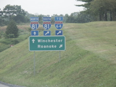
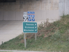
Looking east on US 250 at Staunton, the I-64 sign has a state name and the I-81 signs do not.
Here, no state name in the I-64 sign.
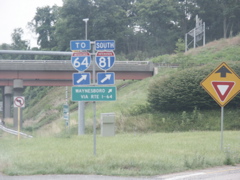
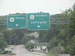
Overheads on I-81 south at the I-64 exit.
The exit sign has the route shield inside.
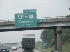
Overhead for the VA 262 southern exit on I-81 south.
The VA 262 exit.
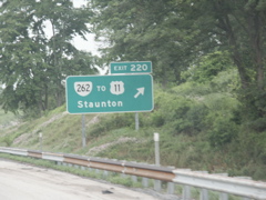
Exiting VA 262 onto US 11.
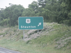
Signs for north and south US 11 at the end of the ramp from northbound VA 262.
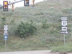
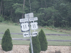
This sign is for southbound US 11 traffic. VA 262 ends at the interstate.
Heading south out of Staunton on US 11.
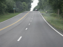
Like much of rural US 11 in this area, a lot of the route is three lanes.
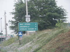
South of Mint Springs.
Interesting sign assembly south of Mint Springs, with a US 11 cutout and a small (18 x 18) US 11 sign.
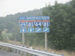
Approaching I-64 and I-81 near the southern terminus of US 340.
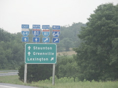
Even though the rightmost I-81 sign has a smaller font, there is no state name like the leftmost I-64 sign.
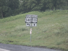
Approaching the southern terminus of US 340.
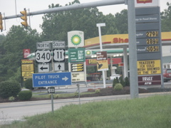
At the turn to US 340.
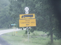
Truck turnaround signage just south of US 340 on US 11.
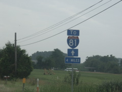
"To I-81" signs are well posted along US 11. This one gives a mileage total.
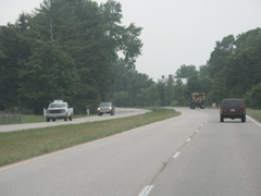
South of Greenville, US 11 expands to four lanes and is such for most of the distance on southward to Lexington.
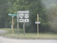
The western terminus of VA 56.
Heading toward Lexington, US 11 travels through rolling valley farmland.

A shot of the four-lane US 11.
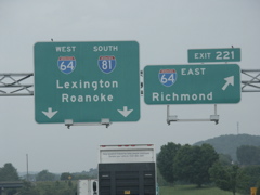
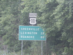
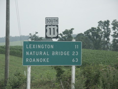
This font appears suspiciously like Clearview. On southbound US 11 at the I-81 Lexington exit.
Getting closer to Lexington.
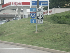
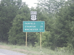
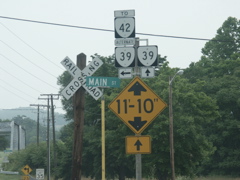
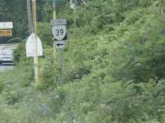
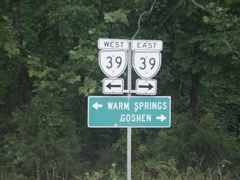
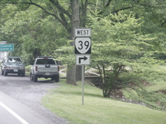
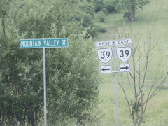
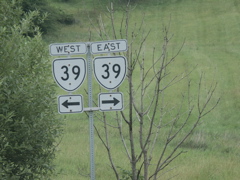
Approaching the eastern terminus of the multistate VA 39.
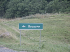
At the terminus for VA 39. This route connects US 11 at Lexington, Va. to US 60 at Gauley Bridge, W.Va., traveling through some very scenic mountainous countryside.
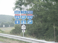
State name signs for I-64 along with an I-81 shield and a Bike Route 76 sign on US 11 south.
Beyond I-64, US 11 heads for downtown Lexington.
Overheads for the split of US 11 and the business route.
These signs can be found on southbound US 11 just beyond the business route's split.
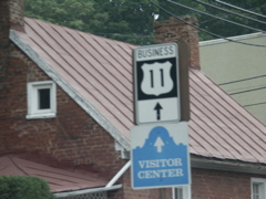
"Unisign" for Business US 11 in Lexington.
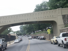
Business US 11 splits the campus of Virginia Military Institute. This bridge spans the route as it travels through VMI.
"Unisign" for US 60 on Business 11.
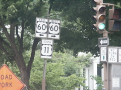
"Unisign" for US 60 and US 11.
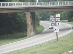
This is back on northbound US 11, just beyond the US 60 intersection.
At the terminus of VA 39 from the prospective of northbound US 11.
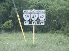
The first VA 39 sign.
These cutouts are located on a service road near the intersection of VA 39 and US 11. The "To" banner is a bit oversized for these smaller cutouts. In the background is the signage on southbound US 11 at the entrance to westbound I-64.
At the southern terminus of US 252 outside of Lexington.
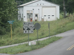
The terminus itself is a "Y."
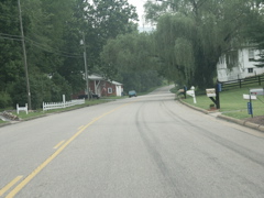
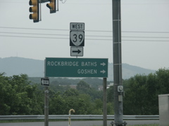
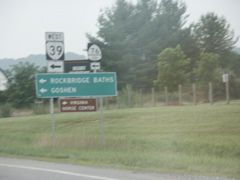
Looking at VA 39 as it travels through the community of Rockbridge Baths.
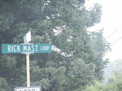
Rick Mast, the NASCAR driver, is Rockbridge Baths' most famous son and he has a street named after him. there.
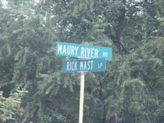
Another street sign for Rick Mast Loop.
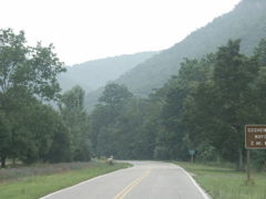
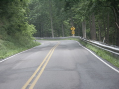
Looking ahead at Goshen Pass on VA 39.
This is the terminus of Alternate Va 39 in Goshen.
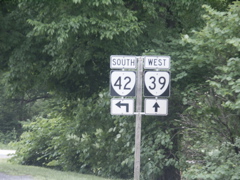
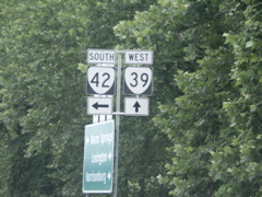
Approaching the intersection of VA 39 and VA 42.
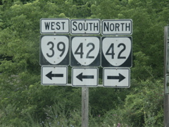
At the intersection.
Heading west on VA 39 at the northern terminus of VA 39 alternate.
At Alt 39.
Heading west out of Goshen, no mention of the destinations of VA 39.
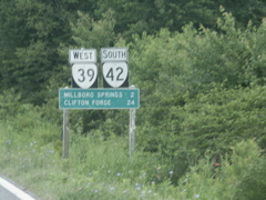
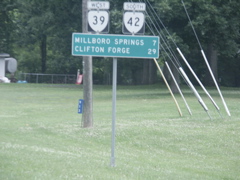
Approaching Millboro Springs.
Approaching the departure of VA 42.
VA 42 turns toward Clifton Forge. The Clearview font sign shown on Day 1 of the trip can be seen here.
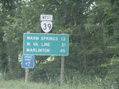
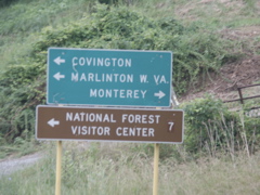
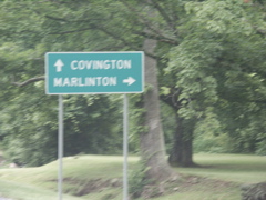
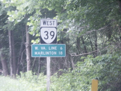
Marlinton, Va. shows up as a destination on VA 39.
Further down VA 39.
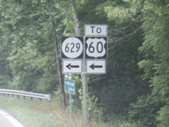
Secondary 629 leads toward Covington and US 60.
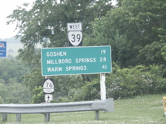
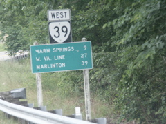
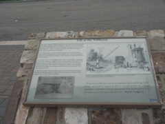
Cutouts for VA 39 between Millboro Springs and Warm Springs.
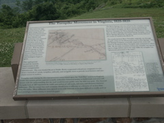
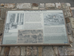
This is one of the displays at the Dan Ingalls Overlook, on VA 39 at the top of Warm Springs Mountain.
Another view of the display.
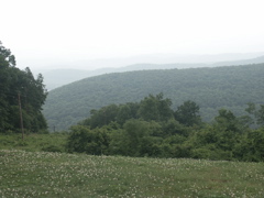
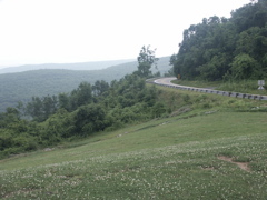
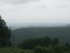
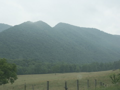
Looking out east into the mountains on a foggy, hazy morning.
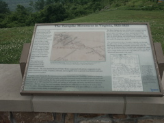
Another display.
This shows VA 39 descending the east side of Warm Springs Mountain.
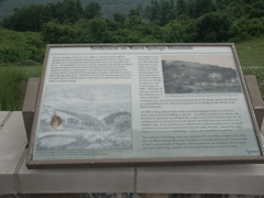
Another display at the overlook.
And yet another one.
Looking out to the mountain ranges in the east.
Descending on VA 39 toward US 220.
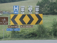
At the intersection of VA 39 and US 220.
VA 39 has only a short run on US 220 before it splits away.
Marlinton is the next town for VA 39. It's in West Virginia.
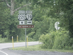
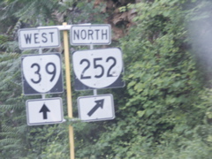
At the split of VA 39 and US 220.
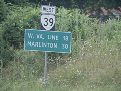
West VA 39 sign atop a Clearview mileage sign just past US 220.
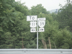
Cutouts located just west of US 220.
A closeup shot of the cutouts.
VA 39 leaves the Jackson River valley and climbs westward.
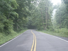
A tree-lined canopy.
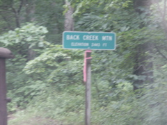
At the top of Back Creek Mountain on VA 39.
Getting closer to West Virginia.
A shot of the mountains along VA 39 approaching the West Virginia state line.
VA 39 begins its climb to the state line and the Eastern Continental Divide.
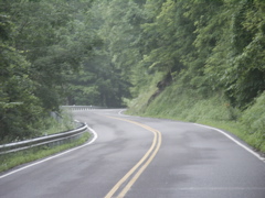
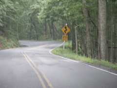
More curves as VA 39 nears the state line.

A tell-tale sign we're getting ready to leave the Old Dominion.
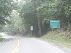
Entering West Virginia.
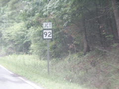
Immediately upon entering West Virginia, WV 39 intersects WV 92.
WV 92 is the main route from I-64 to the ski resorts in this region of West Virginia.
WV 92 and WV 39 join for a few miles.
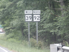
WV 39 and WV 92.
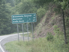
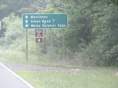
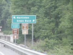
Minnehaha Springs is where WV 39 and WV 92 split. It's an easy drive to Marlinton.
Typical view of WV 39 and WV 92.
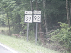
Older WV 39 and WV 92 signs just outside Minnehaha Springs.
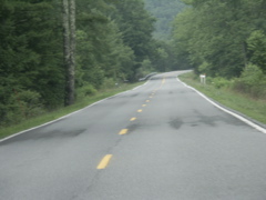
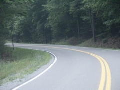
Another typical view of WV 39.
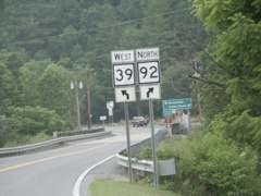
Approaching the split of WV 39 and WV 92.
Green Bank is listed as the destination for WV 92 and has been such since White Sulphur Springs.
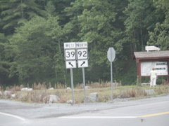
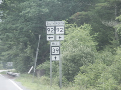
At the split.
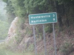
Huntersville is the southern terminus of WV 28.
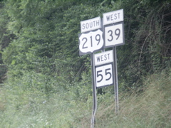
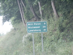
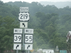
Beyond WV 28, Mill Point is where WV 39 and WV 55 split from US 219, south of Marlinton.
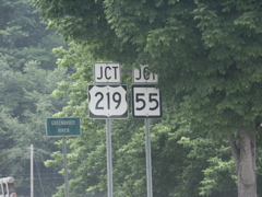
Approaching US 219 and WV 55 in Marlinton.
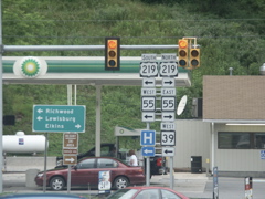
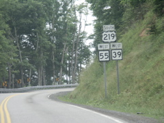
These signs have been replaced since 2003.
These signs, however, haven't. The post was bent when I last passed through here and it's still bent.
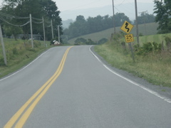
Heading out of Marlinton.
Still climbing out of Marlinton.
Typical view of the crooked, curvy, hilly US 219 not too far north of the WV 39 and WV 55 split.
Advance signage for the split.
Approaching the split.
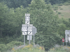
At the split.
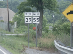
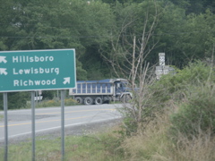
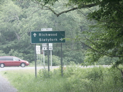
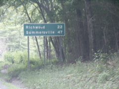
Heading west on WV 39/55 toward Richwood.
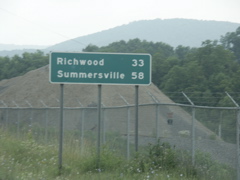
It's an easy, scenic drive to Richwood.
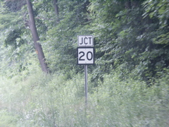
At the intersection of WV 150, the Highland Scenic Highway.
Despite the signage, the Highland Scenic Highway also continues straight.
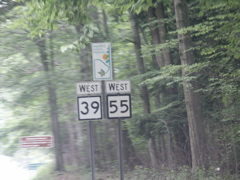
West WV 39 and 55 signs with the Highland Scenic Highway logo.
Getting closer to Richwood.
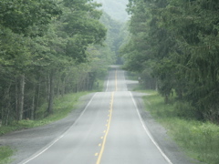
This is a typical view of WV 39/55 heading toward Richwood.
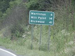
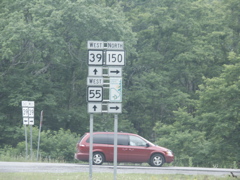
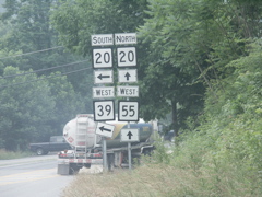
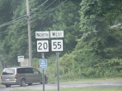
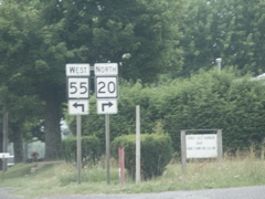
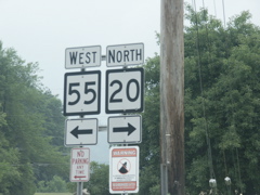
Beyond Richwood, WV 39 joins WV 20 going south and WV 55 joins it going north.
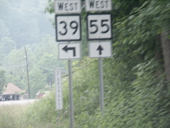
Signage approaching the split of WV 39 and WV 55.
Destinations for WV 20, WV 39 and WV 55.
Signage at the intersection.
Heading north on WV 20 and taking WV 55 along.
Craigsville is where WV 20 and WV 55 split.
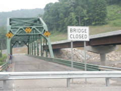
This old bridge across the Gauley River on WV 20/55 was recently replaced. The gentleman shown in the photo said the state was still deciding whether to tear the old bridge down or keep it for a tourist attraction.
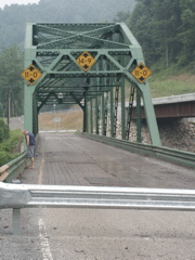
This photo shows that the bridge had an open metal grate floor with several solid metal patches.
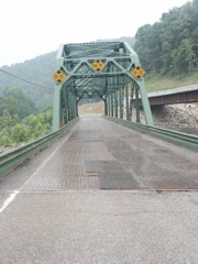
Another shot of the bridge.
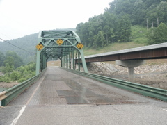
This shot shows how extensively the bridge deck had been patched.
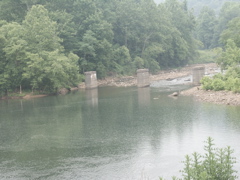
This photo shows the mouth of the Cherry River at the Gauley River with some old bridge piers visible.
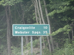
Approaching the split of WV 55 and WV 20 at Craigsville.
Destinations for WV 55 and WV 20.
Signate at the split.
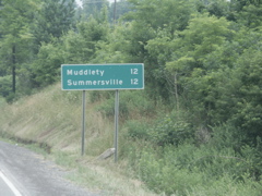
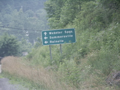
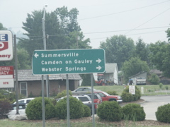
Muddlety is the terminus of WV 55 at US 19. WV 41 goes to Summersville.
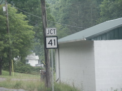
Approaching the northern terminus of WV 41.
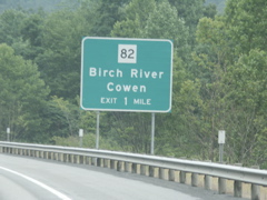
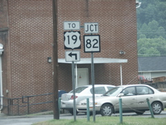
This exit sign is on northbound US 19 approaching WV 82.
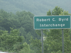
On the Robert C. Byrd Appalachian Highway System, there is the Robert C. Byrd Interchange.
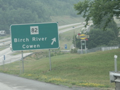
Exiting US 19 at Birch River.
These signs are on the county route paralleling US 19 in Birch River.
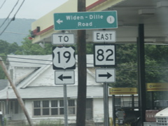
The western terminus of WV 82 lies just to the left at US 19.
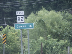
Heading east on WV 82. This is about the closest thing to a Virginia route marker and mileage sign combination as you will find in West Virginia.
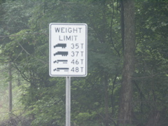
When the Road Sign Math site goes back online, this one is a submission.
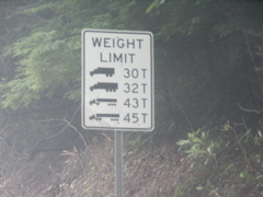
This one is, too.
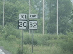
Approaching the end of WV 82.
At the end of WV 82.
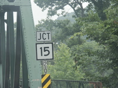
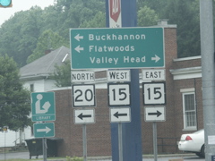
Approaching the intersection with WV 15 in Webster Springs on WV 20.
WV 20 makes a left turn.
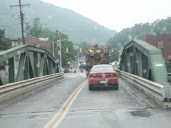
Crossing the Elk River on WV 20 in a light rain.
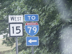
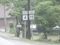
This used to be the terminus of WV 15 before it was extended westward to reach Flatwoods and WV 4, near US 19 and I-79.
Heading out of Webster Springs on WV 15/20.
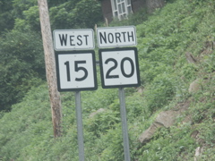
At the WV 15/WV 20 split at Diana, it's a long way to anywhere on WV 20 north.
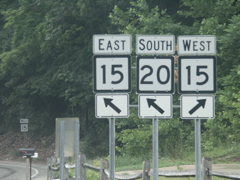
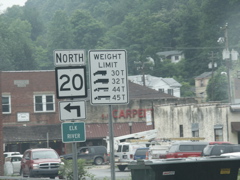
This is where WV 15 east joins WV 20 south.
Heading north on WV 20 at the WV 15 split.
WV 15 splits from WV 20.
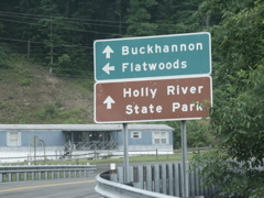
Flatwoods is where US 19 and WV 4 meet I-79.
Typical view of WV 15 heading toward Flatwoods.
This is the first hint of I-79 along WV 15.
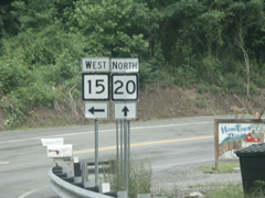
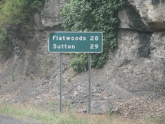
Approaching the end of WV 15, between Flatwoods and Sutton.
The end of WV 15.
This is on I-79 south. It, too, would be a Road Sign Math winner.
New Clearview sign on I-64 westbound, erected in conjunction with a project to reconstruct the exit.
Another new Clearview sign.
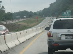
Traffic on I-64 is down to one lane in each direction because of the project. Over in the eastbound lanes, that traffic has gotten on I-64 at the exit just beyond the hill in the background.
One-mile Clearview sign.
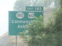
This new sign is obscured by trees. Very poor placement.
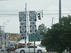
US 60, KY 1 and KY 7 signage in Grayson.
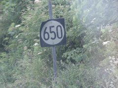
This old KY 650 sign is still in existence on KY 7 southbound, just outside Sandy Hook.