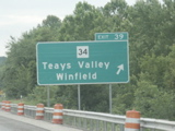
Exit signage for WV 34 on eastbound I-64.
Overheads for Exit 44 and Exit 45 on eastbound I-64.
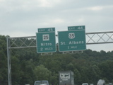
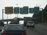
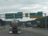
Overheads on I-64 as the route begins its crossing of the Kanawha River just past the US 35 exit.
Overheads for Exits 47A and 47B for WV 622.
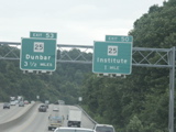
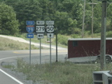
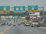
Overheads for Exit 50 and Exit 53, both for WV 25.
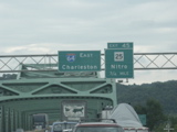
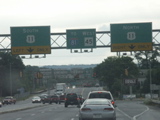
Overheads for Exits 53 and 54 on I-64 east.
Overhead for Exit 54 at the end of the Kanawha River bridge in South Charleston.
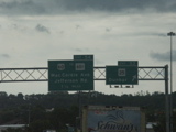
Overhead for intersection of three interstates on I-64 eastbound.
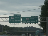
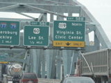
Overheads for Exits 58A, 58B and 58C with a "tipping trucks" curve marker.
Crossing the Kanawha River for the third time on I-64 east, Signage for Exits 58B and 58C with part of the three-interstate junction signage at left.
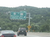
Overheads for Exit 58C and Exit 59.
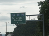
Overheads at the interstection of I-64 and I-77.
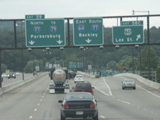
Overhead for Exit 102 and diagrammatical sign for Exit 104.
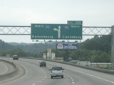
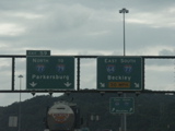
Diagrammatical overhead for intersection of I-77 and I-79.

Intersection of I-77 and I-79.
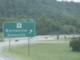
Exit signage at Exit 79, WV 5 Burnsville/Glenville.
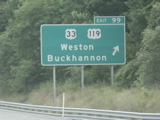
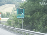
Signage for Exit 99, which is the beginning of Corridor H.
I-79 High Tech Corridor sign.
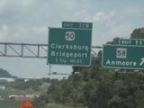
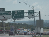
Partial view of button copy sign for WV 58 exit and overhead for Exit 119.
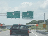
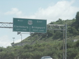
Overheads at Exit 119 and overhead for Exit 121.
Overhead at end of off-ramp from northbound I-79 to US 50.

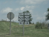
US 50 markers at the end of the off-ramp.
Button copy overheads on US 50 east heading away from I-79.
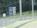
Signage for the beginning of WV 58 from US 50 east.
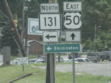
Signage for southern terminus of WV 131 as seen from east US 50.
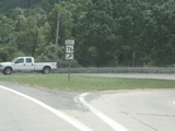
Signage for beginning of WV 76 as seen from US 50 eastbound.
Signage for terminus of WV 279 as seen from US 50 eastbound.
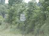
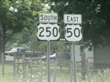
Jct US 250 sign on US 50 east.
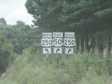
Advance signage for intersection of US 250 and US 50.
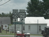
Signage at the intersection of US 250 and US 50.
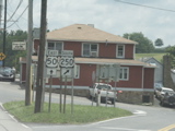
Markers for shared route of US 250 and US 50.
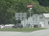
Advance signage for split of US 50 and US 250 with an unusual shape for the US 250 shield.
Split of US 250 and US 50 in Pruntytown, near Grafton.
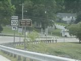
Signage for southern terminus of WV 310 from US 50 east.
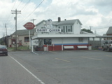
Old Dairy Queen in Grafton.
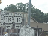
Intersection of US 50 and US 119 in downtown Grafton.

Another shot of signage at the US 50-US 119 intersection in Grafton.

Mileage sign heading east on US 50 otu of Grafton.
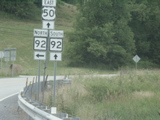
Intersection of US 50 and WV 92.
US 50 and WV 92 markers.

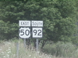
Split of US 50 and WV 92.

Southern terminus of WV 26 at US 50 at Fellowsville.
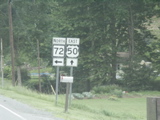
Intersection of WV 72 north and US 50 east at Macomber.
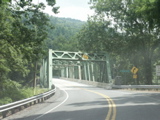
Crossing the Cheat River east of Macomber.

Northern terminus of WV 24 as seen from US 50 east, just west of the Maryland state line.
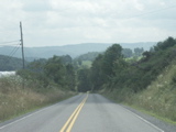
Going south on WV 24, between US 50 and US 219. The mountains in the background are the tallest in Maryland.
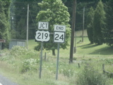
End signage for WV 24 approaching US 219.
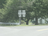
Signage at the end of WV 24.
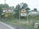
Crossing into Maryland on US 219.
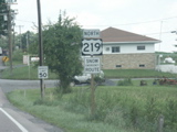
First US 219 marker in Maryland.
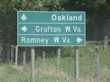
Destination sign on US 219 north approaching US 50.
US 50 signs at the intersection of US 219 and US 50.
Distance sign on US 50 east of US 219.
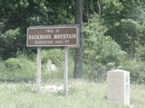
US 50 crosses Backbone Mountain in Maryland. Maryland's highest point is along Backbone Mountain southwest of hear, near the West Virginia state line and the Potomac River headwaters.
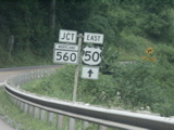
JCT MD 560 and US 50 signs approaching MD 560's terminus at Gorman.
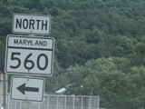
North MD 560 sign approaching the West Virginia state line.
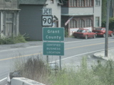
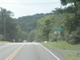
Crossing back into West Virginia on US 50, with JCT WV 90 sign.
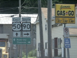
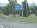
Signage at the northern terminus of WV 90 as seen from US 50 east.
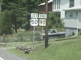
End signage on WV 90 approaching US 50.
US 50 signs at the end of WV 90.
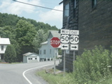
US 50 and WV 42 intersection at Mt. Storm.
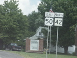
US 50 and older WV 42 markers in Mt. Storm.
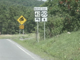
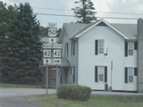
Advance signage for split of WV 42 and US 50.
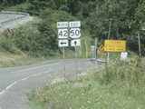
Split of US 50 and WV 42, beginning a long descent.
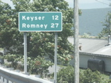
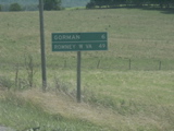
Mileage sign for Keyser and Romney as the hill descent begins on US 50.
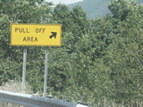
Pull off area for trucks to check their brakes.
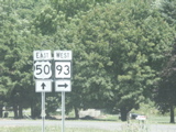
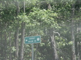
Signage for the terminus of WV 93 on US 50.
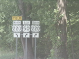
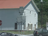
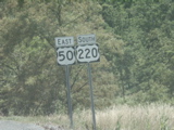
Advance signage for the intersection of WV 972 and US 50. WV 972 is signed as North US 220 from eastbound US 50.
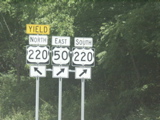
Signage at the intersection of US 50 and WV 972.
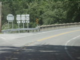
The intersection of US 50 and WV 972, which is signed as US 220 north at this location.
The Hershey Hollow Road sign that was previously highlighted in the June 2002 trip gallery.
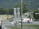
Intersection of US 220 and US 50.
US 50 and US 220 markers.
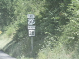
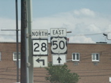
Intersection of US 50, US 220 and WV 28 in Junction.
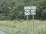
US 50 and WV 28 markers.
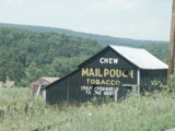
And old Mail Pouch barn along US 50/WV 28 west of Romney.
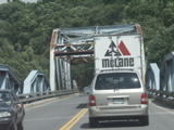
Crossing a fork of the Potomac River outside Romney.
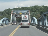
Another shot of the bridge crossing.
US 50 and WV 28 markers on one post.
Advance signage of split of US 50 and WV 28 in Romney.

WV 28 low clearance sign on US 50 in Romney.

Split of US 50 and WV 28 in downtown Romney.

Error signage on westbound US 50 in Romney, shows WV 28 as County 28 (or is that KY 28???).

Distance signage on US 50 heading out of Romney.

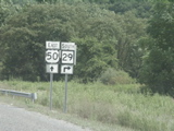
Intersection of US 50 and WV 29 at Pleasantdale.

US 50 and WV 29 markers.
Advance signage for split of US 50 and WV 29.
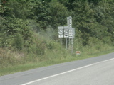
Split of east US 50 and south WV 29.
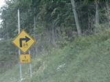
Curve advisory sign with the speed inside the "bend" of the curve arrow.

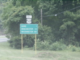
Destination sign for US 50 east near Capon Bridge.

Crossing into Virginia on US 50 east.
Welcome to Virginia sign on US 50 east.

Blurry advance signage for intersection of US 50 and WV 259.

Northern terminus of multi-state route VA 259, which makes a run through West Virginia before ending at US 11 near Harrisonburg, Va..
US 50 marker and mileage sign east of the VA 259 intersection.

VA secondary 684 marker at Gainesboro. This is an old alignment of US 522.

Signage at the intersection of VA 127 and US 522.

VA 127 marker with mileage to towns in two separate states, Romney (WV) and Cumberland (MD).
At this location on VA 127, the center of the highway is the state line. Virginia is on the right and West Virginia is on the left.

Another shot of the section where VA 127 straddles the state line.
VA 127 crosses into West Virginia.

The first WV 127 marker.

End signage, partially obscured, for WV 127 at WV 29.

The terminus of WV 127.

End signage for WV 29 at WV 9.
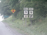
Advance signage for the intersection of WV 9 and WV 29.
The terminus of WV 29 at WV 9.

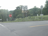
Intersection of US 522 and WV 9 in Berkley Springs.

US 522 and WV 9 markers in Berkeley Springs.

Advance signage for upcoming split of WV 9 and US 522.

Split of WV 9 and US 522.

Older US 522 marker south of Berkeley Springs.

US 522 expands to four lanes just north of the Virginia line.

Crossing into Virginia on US 522.

Welcome to Virginia signage on US 522.

First US 522 marker and mileage sign in Virginia.

Turning around, US 522 crosses into West Virginia.

First US 522 marker in West Virginia.

US 522 and WV 9 intersection in Berkeley Springs.

US 522 and WV 9 markers.

Split of West WV 9 and North WV 522 in Berkeley Springs.

Crossing the Potomac River into Maryland on northbound US 522.

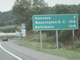
First US 522 marker in Maryland with MD 144 advance signage in the background.

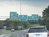
Overheads on US 522 for I-68, US 40, I-70 and US 522.

Directional sign for US 522 and I-70 approaching the I-68 and US 40 interchange.

Doing the weave on I-70, entering from the left and moving to the right to stay on US 522, with the overheads for the eastern terminus of I-68.

Entering Pennsylvania (my first time ever in the Keystone State) on I-70 and US 522.

Pennsylvania welcome sign on west I-70.

US 522 exit signage as seen from the Pennsylvania welcome center ramp on I-70 west.

One-mile sign for US 522 exit.

Low clearance as I-70 passes under PA 484.

US 522 exit on I-70 west with old exit number shown.

Signage at the end of the off-ramp. Note that the I-70 marker on the right (side view) has the state name.

Entrance to I-70 east where US 522 joins the interstate.
Distance signage with error "To US 522" sign on the I-70 assembly.

Exit signage for I-68 and US 40 while still in Pennsylvania.

Exit signage for US 522 while still in Pennsylvania.

One-mile exit signage for US 522's split from I-70.

Half-mile sign for I-68 and US 40.

Crossing into Maryland on I-70/US 522.
Overheads for exit for I-68, US 40 and US 522.

Exit signage for US 522 on I-70 east.

First US 522 marker in Maryland.

Overheads for MD 144 and truck warning on US 522.

Overheads for MD 144 and US 522.

Crossing the Potomac River on US 522 into West Virginia.

Entering West Virginia on US 522.

First US 522 marker in West Virginia.

Intersection of WV 9 and US 522, back in Berkeley Springs.

We've seen this assembly before.

And this one too...

And this one...

West Virginia mile marker on distance sign on WV 9 heading east out of Berkeley Springs.

Jct 901 sign on WV 9 east.

WV 901 and WV 9 intersection.

End signage on WV 901.

End of WV 901 at WV 9.

I-81 signage on WV 9.

More I-81 signage.
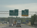
Overheads for exits 13 and 12 on southbound I-81.
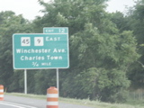
Exit signage for Exit 12 with WV 9 included with WV 45.

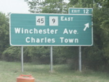
Button copy sign for Exit 12.
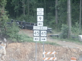
Signage at the exit for WV 45 on I-81 south.
Signage at the end of the off-ramp.

Advance signage for intersection of US 11 and WV 45.
Overheads at intersection of US 11 and WV 45 at Martinsburg.

SIgnage for junction of WV 9 and WV 45 in Martinsburg.

Overheads at intersection of WV 9 and WV 45.

Heading back west on WV 9.

Intersection of WV 9 and WV 45.

Advance signage for intersection of west WV 45 and US 11.
Overheads on westbound WV 45 at US 11.

Overheads for WV 45 and I-81