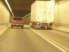
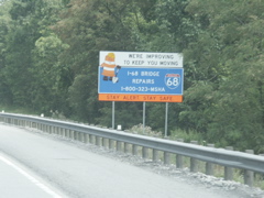
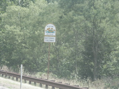
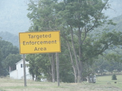
Inside the Allegheny Tunnel on the PA Turnpike. I have no clue why this photo got placed out of order, but it is.
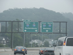
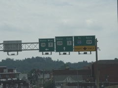
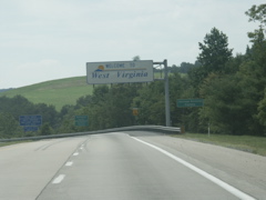
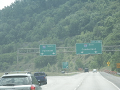
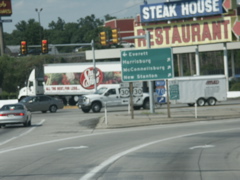
Our photo gallery of the trip to the national roadgeek meeting begins in Charleston, WV, with new overheads on the old gantry at the intersection of I-64 and I-77.
These overheads have also been installed on the old gantries.
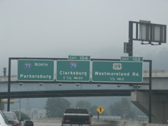
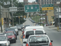
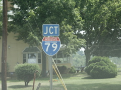
Diagrammatical sign for the interchange of I-77 and I-79.
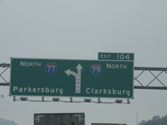
Another diagrammatical sign for the I-77 and I-79 junction.
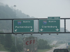
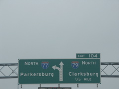
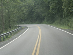
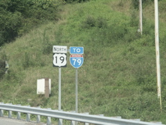
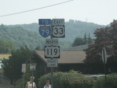
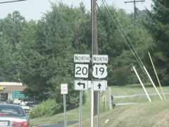
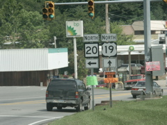
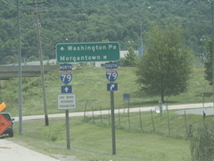
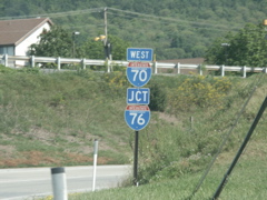
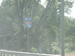
Lane designations at the I-77 and I-79 intersection. This marks the southern terminus of I-79.
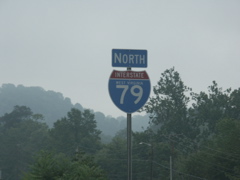
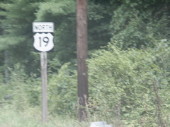
The first I-79 marker.
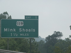
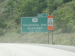
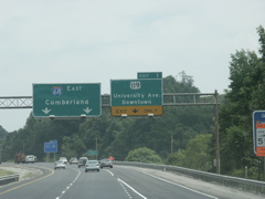
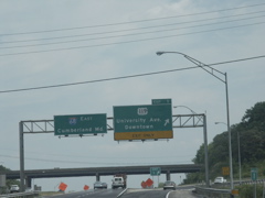
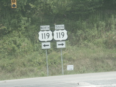
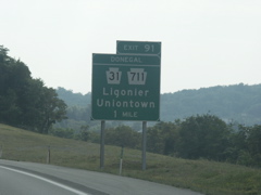
The first exit for I-79 is just north of the route's terminus. It's for US 119.
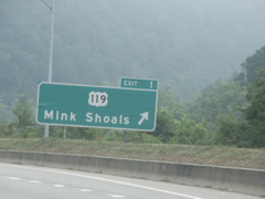
The Mink Shoals exit. This sign is slung low to the ground.
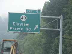
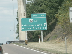
This exit, for County 43, has a shopping center, hotels and restaurants, yet is located in a very rural area.
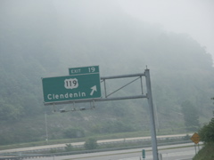
US 119 intersects I-79 again on its route between Clendenin and Spencer.
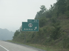
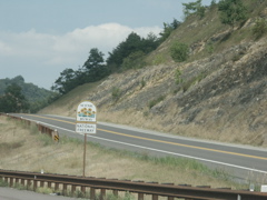
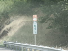
County 29 has an intersection with I-79. If I had been thinking, I could have gotten a Road Sign Math winner photo at the two-mile advance for this exit.
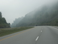
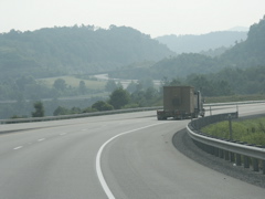
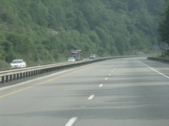
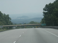
Fog shrouds a road cut on I-79 north of the Amma exit.
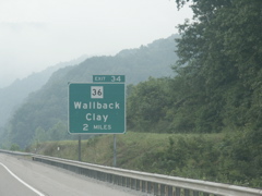
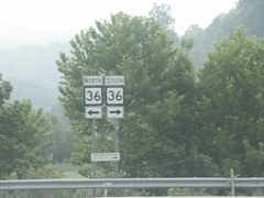
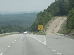
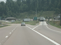
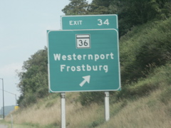
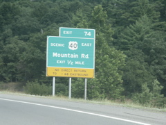
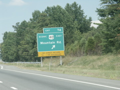
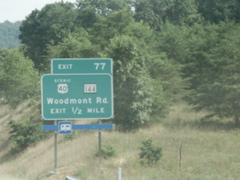
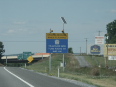
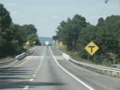
Here's a Road Sign Math winner! Approaching the WV 36 exit at Wallback.
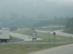
A look at the WV 36 exit.
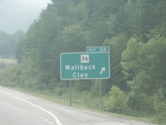
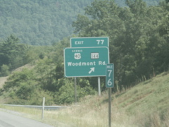
Exit signage at the WV 36 exit.
WV 36 markers at the end of the ramp from I-79. WV 36 runs between Clay and Spencer.
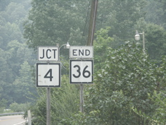
End signage for WV 36 at WV 4 near Clay Junction.
The actual end of WV 36 is a "Y" with a home and church located inside it.
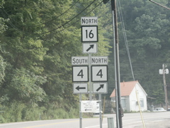
Another Road Sign Math winner! This portion of West Virginia seems to be full of them. This is on WV 16 at Clay Junction.
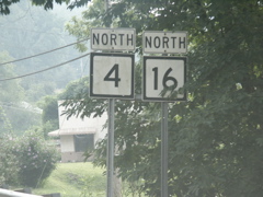
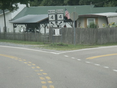
WV 4 and WV 16 run together from Clay Junction to Ivydale.
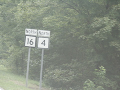
The last joint signage for WV 16 and WV 4 is located just prior to the routes' split at Ivydale.
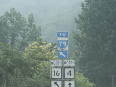
Advance signage for the split of WV 16 and WV 4.
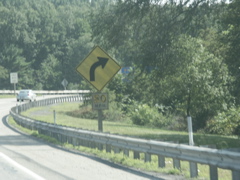
WV 16 takes off up a hill at an angle from WV 4.
This is a typical view along WV 16 between Ivydale and Big Otter.
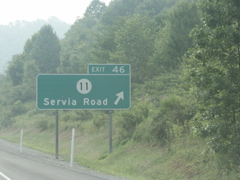
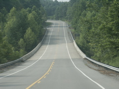
Back on I-79, County 11 intersects at Exit 46.
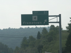
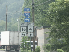
Exit 51 is for WV 4 and is signed with an overhead. Unlike most overheads in West Virginia, this one does not have lights.
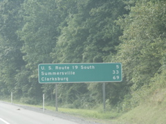
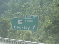
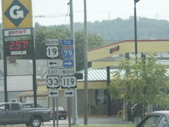
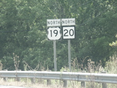
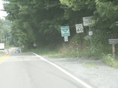
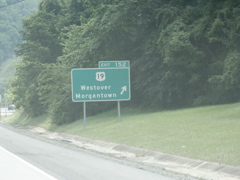
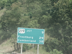
This is a rather wide mileage sign because of the "U. S. Route 19 South" verbiage. It could have been made smaller by saying only US 19 South.
In the distance is the US 19 (Corridor L) exit on I-79.
Exit signage on I-79 at the US 19 exit.
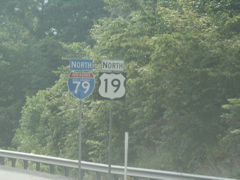
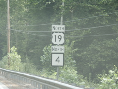
The first joint signage for I-79 and US 19.
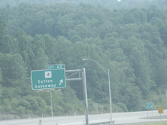
Overhead signage for the WV 4 exit at Sutton. This one has lights.
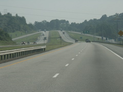
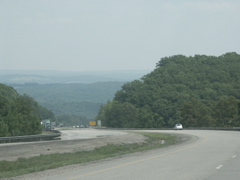
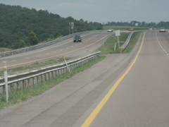
North of WV 4, the median on I-79 narrows and the two lanes are separated by a small raised median and dual guardrail.
Approaching the Flatwoods exit, where US 19 splits from I-79.
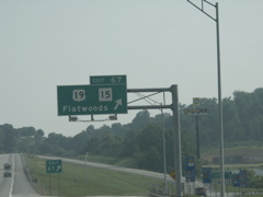
Overhead signage for the Flatwoods exit.
Signage at the end of the northbound I-79 exit ramp. The similar signage at the end of the southbound ramp was my first West Virginia submission to Road Sign Math. Since this one is at pretty much the same location, it doesn't count.
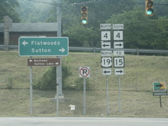
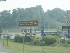
This signage directs drivers to US 19, WV 4 and WV 15.
Mileage sign on US 19 after leaving I-79.
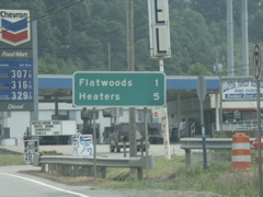
Just a few dozen feet north of the previous mileage sign is this one.
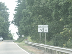
US 19 and WV 4 run concurrently north of Flatwoods.
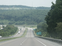
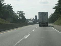
This section of US 19 near Burnsville Lake has been improved.
Signage for both routes on one post.
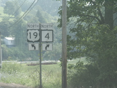
Advance signage for the split of WV 4 and US 19.
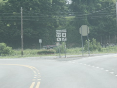
WV 4 and US 19 split at a "Y" which is common in West Virginia.
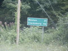
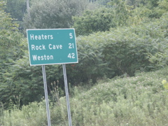
The split of WV 4 and US 19 is approximately halfway between Flatwoods and Weston, as evidenced by this sign located just north of the split.
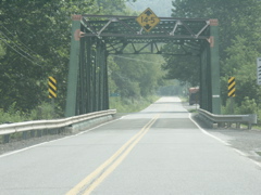
Old truss bridge on US 19.
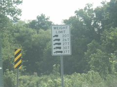
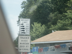
This weight limit sign has a number of different posted weights, depending on the size of the truck. Surely there is a math equation here somewhere.
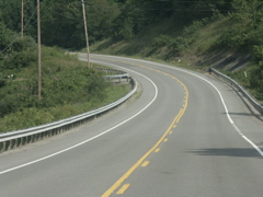
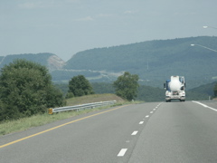
Near Stonewall Jackson Lake and Roanoke, US 19 has been improved.
Signage near Roanoke features a To I-79 trailblazer.
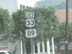
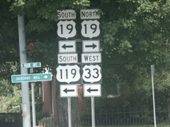
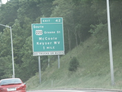
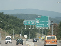
In downtown Weston, US 19 approaches US 33 and US 119.
US 33 and US 119 briefly join US 19 through Weston. West US 33 and south US 119 head across the north-central part of the state toward Spencer.
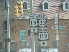
East US 33 and North US 119 join North US 19.
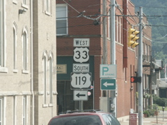
After a short joint routing, US 33 and US 119 split from US 19.
US 19 turns left, US 33/119 turn right.
The three US routes follow one-way streets through Weston.
Heading out of Weston on US 19.
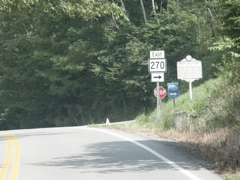
This is the terminus of WV 270 as seenn from US 19 northbound.
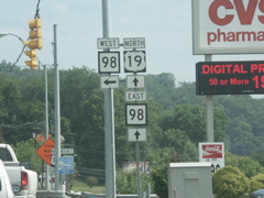
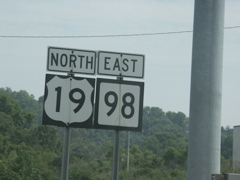
US 19 and WV 98 run concurrently in the southern part of Clarksburg.
Older US 19 and WV 98 signs.
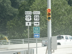
WV 98 is routed along a new bridge. The border on the newly-installed WV 98 sign is a little thicker than normal.
Heading out of Clarksburg, US 19 and WV 20 run concurrently.
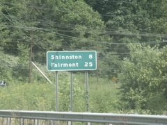
It is certainly a lot quicker to drive between Clarksburg and Fairmont on the interstate than on US 19.
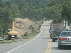
A bridge replacement project on US 19 north of Clarksburg.
Bridge weight limit signage. Is there a math problem in all these numbers?
Advance signage for the split of US 19 and WV 20.
WV 20 is the state's longest state route. It runs from near Princeton, in the southern part of the state near the Virginia state line, to New Martinsville on the Ohio River.
Signage at the split of US 19 and WV 20.
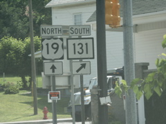
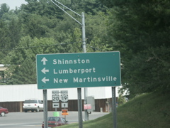
This is the signage at the terminus of WV 131 in Shinnston.
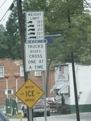
More weight limit signage. Somebody do the math for me!
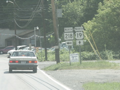
This is the southern terminus of WV 218 as viewed from US 19 northbound.
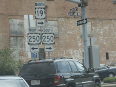
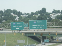
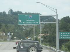
Signage for US 19 and US 250 in downtown Fairmont.
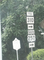
Signage for US 250 and WV 310 at the US 19 intersection.
More signage for US 19 and US 250 in Fairmont.
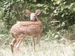
I spotted three fawns along US 19 north of Rivesville, above where it makes a turn away from the Monongahela River and heads up the hill. I grabbed my camera and was able to get this slightly out-of-focus photo of one of the spotted fawns, looking back over its shoulder at me.
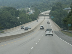
US 19 meets I-79 outside Morgantown.
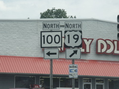
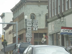
This is the southern terminus of WV 100.
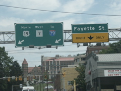
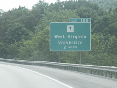
Overhead signage as US 19 approaches US 119 and WV 7 in downtown Morgantown.
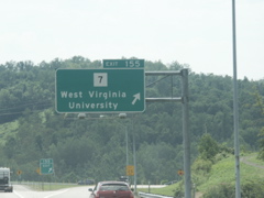
A busy city street in Morgantown and overhead signage for US 19 and WV 7.
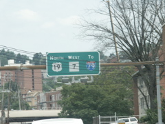
A closer view of the overheads.
Overhead on US 19 with WVU buildings in the distance.
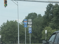
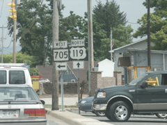
Advance signage for WV 705 near the WVU coliseum. This WV 705 signage has a much thicker border than usual.
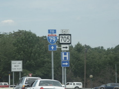
Another WV 705 sign with the top and bottom black borders thicker than the sides.
US 19, WV 7 and I-79 signage north of the WVU campus.
Advance signage for the connector between US 19/WV 7 and I-79. This leads to the WVU exit on I-79.
Overhead signage for the I-79 connector.
Advance signage for the WV 7/US 19 split.
At the split. Note the older arrow under the US 19 sign.
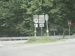
This is the northern terminus of WV 100. WV 100 has crossed US 19 in Morgantown but the intersection was not marked.
Crossing from West Virginia into Pennsylvania on US 19.
Sorry for the blurry photo -- this is the first US 19 sign in Pennsylvania and it looks different than the typical US route marker in the Keystone State.
In Mt. Morris, US 19 is connected to I-79 via city streets. This I-79 marker has the state name.
State name-less shields at the Mt. Morris exit on I-79.
Crossing into West Virginia on I-79 south.
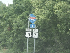
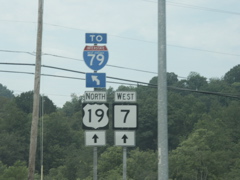
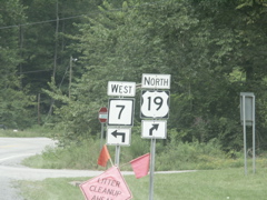
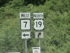
The first exit in West Virginia leads to WV 7 and US 19.
Overhead at the WV 7 exit.
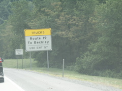
This sign cautions long-distance truck drivers not to use the US 19 exit at Morgantown if they mean to take Corridor L and the shortcut to the WV Turnpike at Beckley. This is also the reasoning behind removing the US 19 shields from the southbound Roanoke exit. Are drivers really that dumb????
The US 19 Morgantown exit.
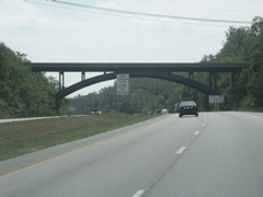
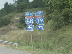
An arched bridge crosses I-79 between US 19 and I-68.
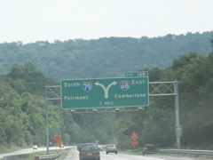
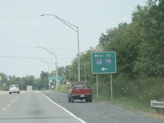
One-mile diagrammatical overhead approaching I-68.
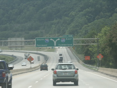
Overhead signage and the interchange of I-68 and I-79.
Lane designation overheads at the exit ramp.
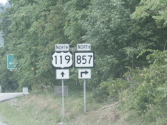
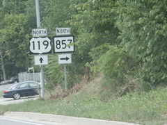
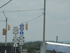
While on the ramp from I-79 to I-68, the first US 119 exit sign is seen.
This overhead on I-68 features an unusual font in the US 119 sign.
At the US 119 exit.
Oversized US 119 markers at the end of the off-ramp.
On US 119, a state name I-79 shield is paired with a "neutered" I-68 marker. Non-state name shields are unusual in West Virginia in this context.
Guide signage at the turn from north US 119 to west I-68.
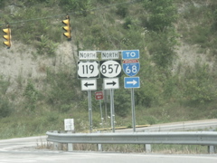
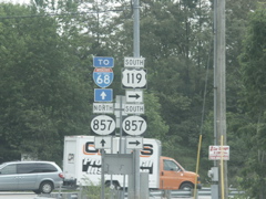
Error signage approaching County 857. The route is signed as a WV state route.
The overhead gets it right -- Route 857 is a county route.
Another signage error for County 857.
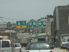
Overheads on US 119 approaching US 19 and WV 7 and a view of the downtown Morgantown area.
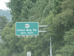
This is the terminus of WV 705 at US 119. Even though WV 705 is signed on the I-68 exit, the interchange is actually with County 857.
Standalone signage for County 857.
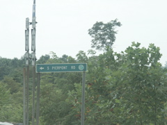
The split of US 119 and County 857. At this location, County 857 is Pierpont Road and it leads to I-68.
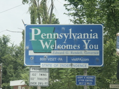
Pennsylvania welcome signage on US 119 entering the Keystone State.
Looking back into West Virginia on US 119 southbound.
Back at Pierpont Road, signage for County 857 along with US 119 and I-68.
This is an old county route sign with the county route number in a light green circle. This setup is rarely used in West Virginia. Most county signage either has black numerals in a white circle, or white numerals in a dark green circle (similar to how California state routes are signed on guide signage).
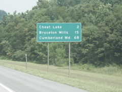
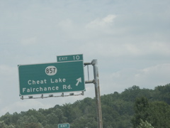
Back on I-68, this is the mileage sign just east of County 857.
Looking down the hill at the Cheat Lake crossing.
The Cheat Lake bridge on I-68.
Overhead signage for the County 857 exit at Cheat Lake.
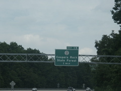
Button copy overhead for Coopers Rock State Forest exit.
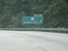
This sign is not button copy and omits the "State Forest' text.
Looking down the hill just past the Coopers Rock exit.
Another downhill shot.
Truck ramp on eastbound I-68.
A look at the Bruceton Mills exit on I-68.
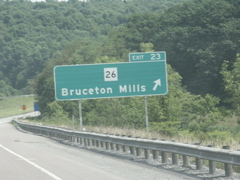
Exit signage at Exit 23.
Just past the Bruceton Mills exit, you can see another uphill climb for I-68 in the distance.
County 5 is the last exit for I-68 in West Virginia.
After the last WV exits, all I-68 destinations are in Maryland.
Maryland was doing a construction project and placed advance signage in West Virginia.
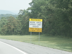
Two different shades of yellow on this MD work zone signage placed just a few dozen feet into West Virginia.
The pavement change marks the state line between West Virginia and Maryland.
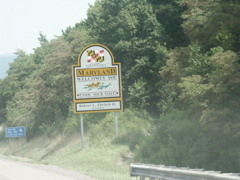
Maryland welcome sign.
Each county along I-68 has a nice welcome sign of this nature.
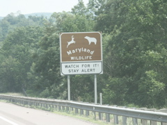
There are several Maryland wildlife signs along I-68.
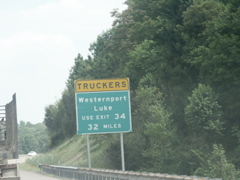
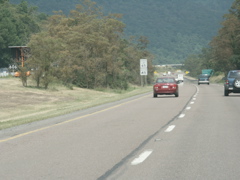
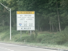
This sign gives plenty of warning to truckers of what exit to use to connect to US 220.
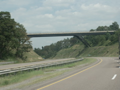
Nice steel-supported bridge crossing I-68 in western Maryland
This is the first exit in Maryland.
Half-mile advance signage for MD 42 exit.
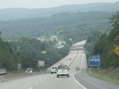
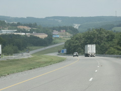
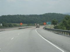
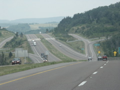
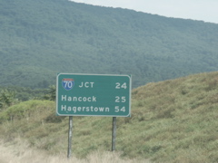
I-68 crosses Maryland's most mountainous terrain as it traverses the distance between Morgantown and Hancock.
The last time I drove this route, in January 2004, there was only a small temporary sign here. You can see it at http://www.millenniumhwy.net/Washington_CD_2004/PICT1035.JPG As you can see, this has been replaced with a full-sized sign.
A bridge renovation project was in progress at the MD 42 exit.
Maryland's mileage signs use route shields for upcoming interchanges.
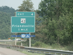
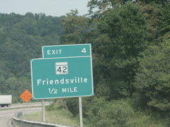
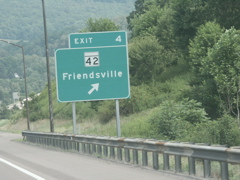
A truck climbing lane on I-68 past Friendsville.
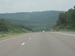
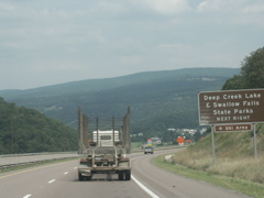
More mountain scenery.
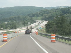
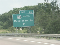
Approaching the US 40/US 219 intersection.
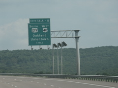
Overhead signage for the US 40/US 219 exit. The sign's lights are powered by solar panels.
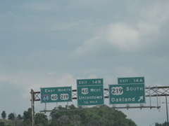
Overheads at Exit 14.
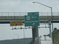
At the exit for US 40 west.
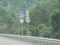
I-68, US 40 and US 219 markers where the three routes are signed together.
Another distance sign with a route shield.
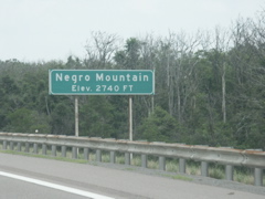
In this day and age of political correctness, I'm surprised this hasn't been changed to African-American Mountain.
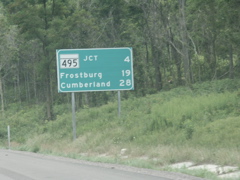
No exit number tab on this exit sign for MD 495.
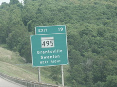
Now there's an exit number.
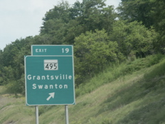
At the exit for MD 495.
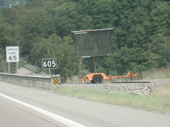
This temporary message sign is permanently parked along I-68.
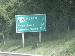
Approaching the split of US 219 from I-68/US 40.
US 219 exits I-68.
A look at Exit 24 on I-68.
Another mileage sign.
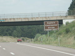
At the Eastern Continental Divide.
One good thing Maryland does is provide deceleration lanes for vehicles needing to use its emergency crossovers. This keeps traffic planning to make a U-turn from having to slow down in the passing lane.
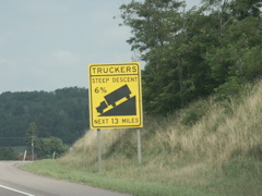
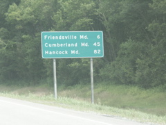
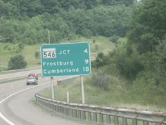
Hill warning for truckers as they head toward Cumberland.
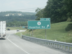
Exit 29.
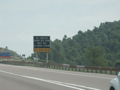
Approaching a weigh station.
Maryland weigh station and truck pulloff/brake check area.
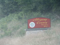
Welcome sign for Allegany County.
Several of these interesting mileposts can be found along the entire length of I-68 in Maryland.
This exit sign features a MD 36 marker that has a wider than usual black line above the numerals.
The median widens out and the two lanes of I-68 run on different alignments heading downhill toward Cumberland.
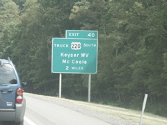
Trucks are kept off of US 220 just south of Cumberland. They are directed to use Exit 40.
Looking downhill on I-68.
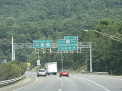
Overheads at Exit 40.
Truck warning for I-68 through Cumberland.
Exit for US 220 south with truck warning.
Overheads for Exit 42. At this point I-68 is separated by a jersey barrier. Cumberland lies in the valley below.
Heading into Cumberland.
Heading out of Cumberland, the exit for Alt. US 40 is the spot where the old US 48 freeway ended.
This photo shows where the I-68 freeway widens out from a jersey barrier median to a wide grass median.
Scenic Byway marker for the Old National Road (former US 40).
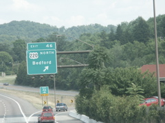
Overhead where US 220 departs from I-68. Unlike where US 219 headed north to Pennsylvania, the state name is missing from this sign. Bedford is in Pennsylvania, of course.
Scenic Byway marker for the National Freeway.
The end of I-68 is only 24 miles away.
This portion of I-68 has been resurfaced recently.
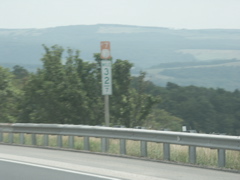
Another unusual mile marker.
Another National Freeway marker.
Construction sign on I-68.
Overhead for Scenic US 40.
The two lanes of I-68 are separated by a guardrail at this spot.
Another unusual mile marker.
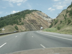
Approaching the Sideling Hill cut.
Before climbing to Sideling Hill, I-68 drops into another valley as it passes Exit 72.
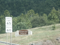
Entering Washington County. What font is that on the speed limit sign?
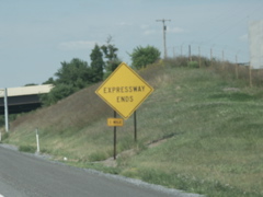
Exit for Scenic US 40 with no re-entry.
At Exit 74.
Going up the hill toward Sideling Hill.
Getting closer.
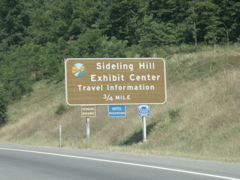
Exit sign for Sideling Hill exhibit.
Almost ready to enter the cut.
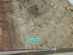
Inside the Sideling Hill cut.
On the other side, another exit for Scenic US 40 and MD 144.
A small MD 144 marker makes this sign unique.
Well, maybe nt that unique. Here's another one.
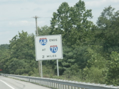
End sign for I-68 approaching I-70. Looks like a Road Sign Math winner to me!
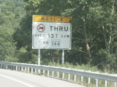
Truck warning sign for MD 144 through Hancock.
Approaching the end of I-68. Note the use of a wide marker for the I-70 shield.
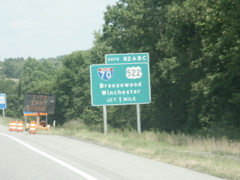
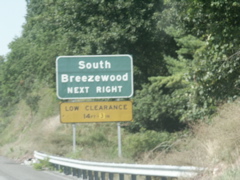
Button copy sign for Breezewood.
The new-style "reduce speed ahead" sign.
Overheads at the eastern terminus of I-68.
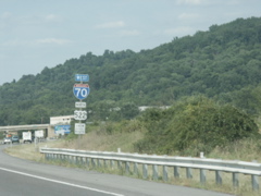
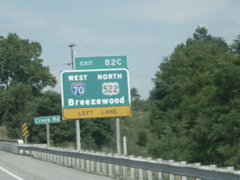
I-70 and US 522 signage with the Pennsylvania state line in the background.
Entering Pennsylvania on I-70 westbound.
Noting the end of the Maryland construction on I-70.
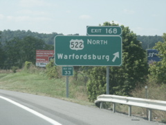
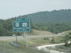
THe first exit on I-70 in Pennsylvania is where US 522 departs.
The text on this sign is centered, which is unusual.
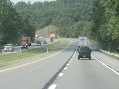
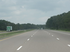
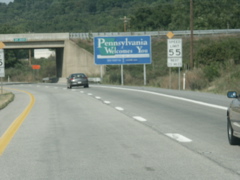
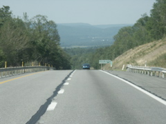
Typical view of I-70 in south-central Pennsylvania. This route carries a 55 mph speed limit.
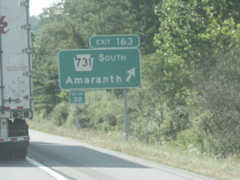
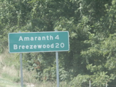
The exit for PA 731.
The lanes on I-70 divide along this section of highway.
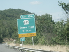
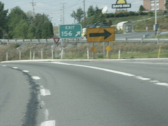
Exit sign for Exit 156 with a speed advisory plate.
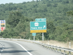
Exit 156.
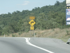
Cautioning exiting traffic that the curve needs to be taken at 15 mph.
And here's why. The ramp makes a 90-degree right turn directly off I-70.
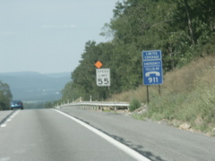
Limited coverage notice on the 911 sign. It's the truth. I had no coverage at this location and my carrier is Cingular.
Drawing closer to Breezewood.
Old button copy mileage sign that can be seen in the distance of the previous photo.
An old rest area? Truck pulloff? What was this used for?
Old button copy and text signage.
Another old sign.
Very old faded button copy sign with text for the route number, with a new exit tab added to the top of the sign.
More very old signage.
Still more old button copy signage.
Still more old faded button copy signage. The new exit tab provides quite a contrast.
The last few miles of I-70 before Breezewood have an abundance of ancient signage.
Old overheads nearing Breezewood. The bridge in the distance is the PA Turnpike.
Turnpike traffic advisory sign as you approach the bridge that carries the Turnpike across I-70.
Warning sign about the impending end of the expressway just prior to the PA Turnpike underpass.
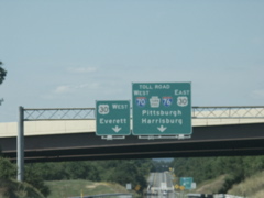
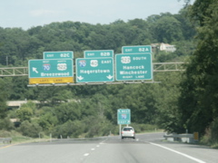
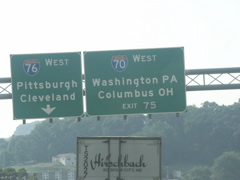
Overheads for US 30, I-70, I-76 and the Turnpike just prior to crossing under the Turnpike.
Signage directing I-70 traffic to follow the PA Turnpike west.
Getting closer to Breezewood. The bridge is where I-70 crosses over itself.
We're getting closer.
What lies beyond this crest?
And there it is!!!! Breezewood in all its glory!
At the end of the freeway, westbound traffic for I-70 joins US 30 east.
Overheads on US 30 for I-70, I-76 and the Turnpike.
And after a block, I-70 turns off US 30. These shields have the state name.
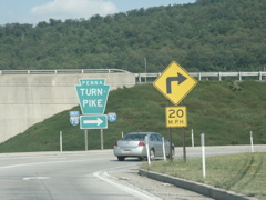
The entrance to the Turnpike.
State name shields once I-70 departs US 30.
Very old curve sign.
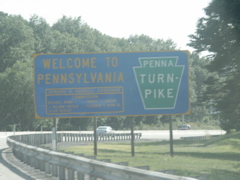
PA Turnpike welcome sign.
I-70 crosses under itself.
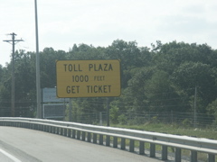
Toll Plaza warning sign.
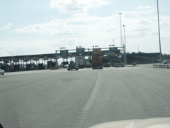
A look at the Breezewood toll plaza.
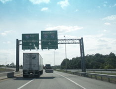
Beyond the toll booth, the overheads for the Turnpike also list the exit numbers accessed.
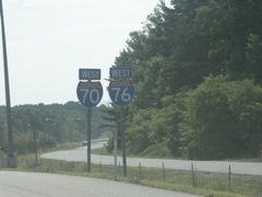
I-70 and I-76 signs on the Turnpike.
And a standalone I-76 sign with I-70 not mentioned.
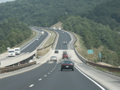
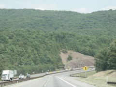
Typical view of the PA Turnpike west of Breezewood.
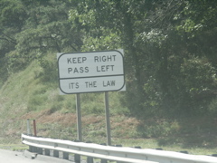
Warning sign about not driving in the left lane.
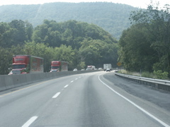
Another view of the turnpike with heavy truck traffic.
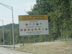
Restrictions for the upcoming tunnel.
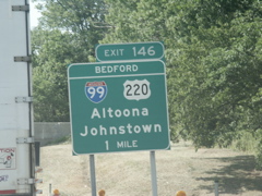
The turnpike features new exit signage that lists the name of the exit at the top. This one is for the infamous I-99.
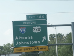
Overhead for Exit 146.
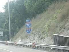
West I-70 and I-76 signage.
I saw more Clearview in my few days in Pennsylvania than I ever had before. These warning signs are posted on freeways and surface routes all over the area.
Here's another.
Another typical view of the turnpike.
The panels on this sign aren't lined up.
Another Clearview sign.
The westbound turnpike begins its ascent toward the Allegheny Tunnel.
The turnpike has three lanes for the hill climb.
One-mile signage for the upcoming tunnel.
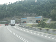
Looking at the tunnel's portal.
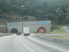
At the Allegheny Tunnel.
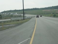
Upon emerging from the western portal, you encounter a ridgetop plateau.
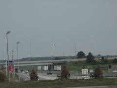
From the Somerset service plaza, looking east at windmills used to generate electricity.
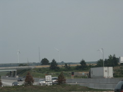
Another shot of the windmills.
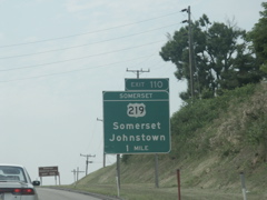
Approaching the Somerset interchance. This isn't really US 219, but is PA 601 instead.
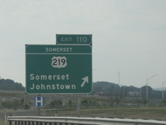
At the Somerset ramp.
Mileage sign to the next two exits, with one of the turnpike's call boxes visible.
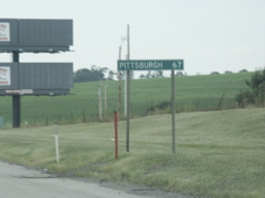
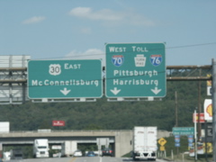
And it's 67 miles to Pittsburgh.
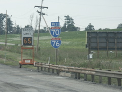
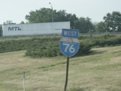
I-70 and I-76 signs with a changeable speed limit sign.
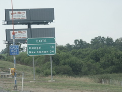
Approaching the Donegal exit.
One-mile sign for the Donegal exit.
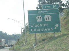
At the Donegal exit.
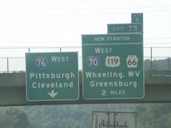
Overheads for the new Stanton exit, where I-70 departs the Turnpike.
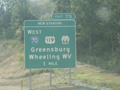
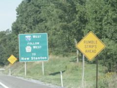
One-mile signage for New Stanton.
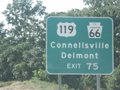
Us 119 and Toll 66 have alternate destinations.
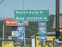
Overheads for I-70 and I-76.
At the New Stanton exit.
Old state name I-76 sign just past the New Stanton exit.
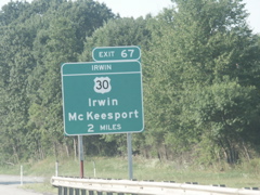
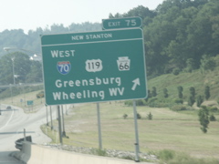
Two-mile signage for the Irwin exit.
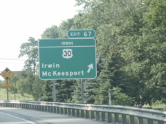
At the Irwin exit. Irwin was the original western terminus of the turnpike. It's basically a suburb of Pittsburgh, as US 30 is built up all the way past Greensburg.
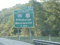
Approaching the I-376 connection to Pittsburg.
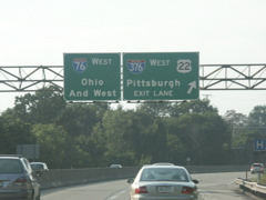
Overheads for "Ohio and West" and Pittsburgh on the turnpike.
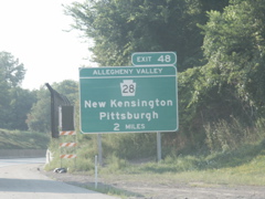
The Allegheny Valley exit connects to PA 28 just after the turnpike crosses the Allegheny River.
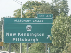
At the Allegheny Valley exit.
Past Allegheny Valley, the turnpike has an unusual center barrier.
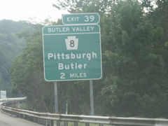
Nearing the Butler Valley exit.
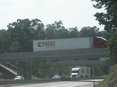
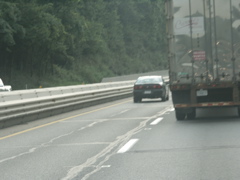
Another shot of the unusual center divider. The truck traffic here is as heavy as it was while I-70 was a part of the Turnpike.
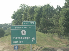
The Butler Valley exit.
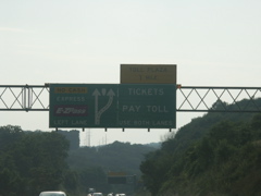
Directional overhead for the Warrendale toll plaza, which is a mainline barrier.
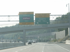
Approaching the Warrendale toll plaza.
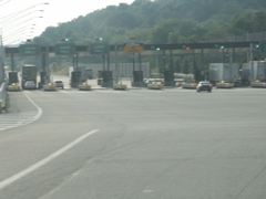
Several lanes to choose from.
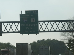
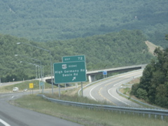
Nearing the new Cranberry Connector and I-79.
One-mile signage.
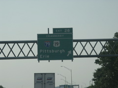
The Cranberry exit.
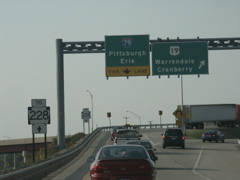
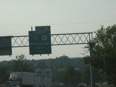
Overheads for US 19 and I-79 and surface PA 228 signage.
Overheads for I-79 north and south at the end of the Cranberry Connector.
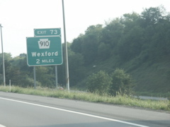
PA 910 exit on I-79 south.
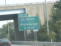
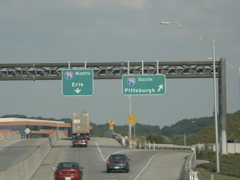
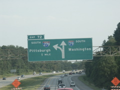
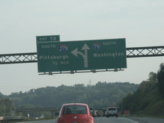
Approaching I-279.

Clearview font on this sign.
Overhead directional sign for I-279. Many of the I-279 signs have the "9" slanted at an odd angle.
Half-mile directional overhead.
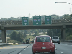
Lane designations for I-279 and I-79.
Looking at the beginning of I-279.
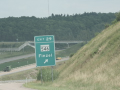
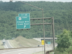
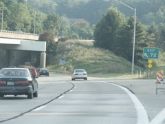
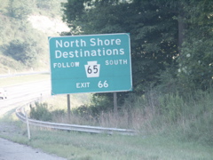
Approaching the PA 65 exit.
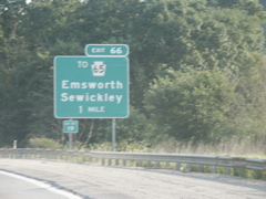
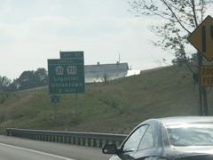
One-mile sign for PA 65. If not for that pesky "Old Exit 19" plate, I'd have another Road Sign Math winner here.
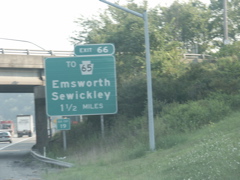
Clearview, anyone?
State name shield.
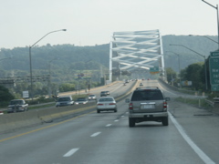
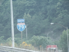
Getting ready to cross the Ohio River on I-79.
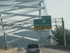
Overhead for the Neville Island exit as you cross the Ohio River.
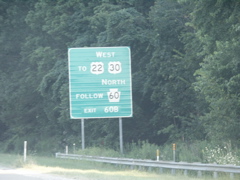
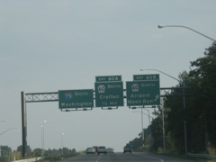
Since there is no direct connection from I-79 south to US 22/30 west, traffic must use Steubenville Pike, PA 60.
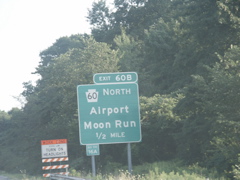
Exit signage for PA 60 north.
Overheads for Exit 60, PA 60.